|
search place name
|
||
Santa Inés (Cesar, Colombia)Santa Inés is a town in the Cesar region of Colombia. An overview map of the region around Santa Inés is displayed below.
regional and 3d topo map of Santa Inés, Colombia ::

Santa Inés airports ::
The nearest airport is MGN - Magangue Baracoa, located 104.5 km west of Santa Inés.
Other airports nearby include VUP - Valledupar Alfonso Lopez Pumarejo (124.9 km north east), OCV - Ocana Aguas Claras (147.9 km south east), CZU - Corozal Las Brujas (150.8 km west), BAQ - Barranquilla Ernesto Cortissoz (177.4 km north west), Nearby towns ::
Arjona (2.4km east) //
La Providencia (2.7km north east) //
La Gloria (3.1km south) //
Nereidas (3.2km east) //
La Esmeralda (3.7km south) //
La Albania (4.2km north east) //
Buenos Aires (4.5km north) //
La Glorieta (4.8km south) //
Tolima (4.8km south east) //
La Divisa (5.4km north) //
Hacienda La Unión (5.6km north east) //
Astrea (6.6km south west) //
El Carmen (6.7km south) //
El Delirio (6.7km south east) //
El Brillante (6.9km east) //
El Yucal (7.3km north east) //
El Descanso (7.4km south east) //
Carolina (7.5km south east) //
Babilonia (7.5km south west) //
Todos Los Santos (7.7km north) //
Ebrón (7.6km east) //
Casablanca (7.6km south east) //
Santanita (8.0km south) //
Santa Catalina (8.2km south) //
El Topacio (8.5km south) //
El Jobo (8.5km south east) //
La Meca (8.7km south west) //
La Esperanza (8.9km south east) //
La Esperanza (9.0km south east) //
[all distances 'as the bird flies' and approximate] 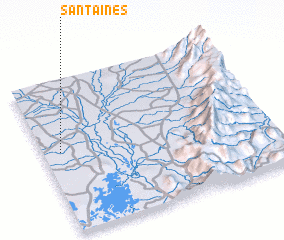 Places with similar names to Santa Inés, Colombia ::
// Santa Inês (BR)
// Santa Inês (BR)
// Santa Inês (BR)
// Santo Inácio (BR)
// Santo Inácio (BR)
// Santo Inácio (BR)
// Santo Inácio (BR)
// Santo Inácio (BR)
// Santo Inácio (BR)
// Santa Ynez (US)
Disclaimer :: Information on this page comes without warranty of any kind |
||
|
Where is Santa Inés? Elevation and coordinates ::
Latitude (lat): 9°31'39"N Longitude (lon): 73°55'36"W
Elevation (approx.): 64m (map arrows pan, magnifying glasses zoom) |
||
|
Visiting Santa Inés? Hotel/Accommodation ::
Book a hotel in Santa Inés Travel Guide ::
Buy a travel guide for Colombia rental cars ::
car rental offers GPS waypoint ::
download a GPX waypoint (PoI) of Santa Inés for your GPS receiver
|
||