|
search place name
|
||
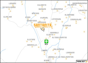
Santa Rita (Norte de Santander, Colombia)Santa Rita is a town in the Norte de Santander region of Colombia. An overview map of the region around Santa Rita is displayed below.
regional and 3d topo map of Santa Rita, Colombia ::
Santa Rita airports ::
The nearest airport is OCV - Ocana Aguas Claras, located 4.5 km south of Santa Rita.
Other airports nearby include CUC - Cucuta Camilo Daza (105.6 km south east), SVZ - San Antonio Del Tachira (117.1 km south east), LFR - La Fria (121.6 km east), BGA - Bucaramanga Palonegro (137.3 km south), Nearby towns ::
Santa Rita (0.6km north west) //
San Isidro (2.8km north) //
Aguasclaras (3.1km south) //
San Isidro (3.2km north) //
El Uvito (3.3km south east) //
Chamizo (3.7km east) //
La Floresta (4.1km north east) //
González (4.6km north) //
San Pablo (4.6km east) //
Convención (4.8km north east) //
Vijagual (5.1km north) //
La Trinidad (5.7km north east) //
San Antonio (6.3km north west) //
El Gitano (6.8km south west) //
La Trinidad (6.9km north east) //
Río de Oro (7.0km south) //
Alto de Los Patos (7.4km south east) //
Brotaré (7.7km north west) //
Sanin Villa (8.2km south west) //
El Curo (8.3km south west) //
Otare (8.5km north west) //
Búrbura (8.8km north) //
Libelú (8.8km south east) //
Cerro de las Flores (8.8km north east) //
Líbano (8.9km south) //
Llano Grande (10.5km north east) //
Cuatro Esquinas (10.5km north east) //
Palogrande (10.5km south east) //
[all distances 'as the bird flies' and approximate]  Places with similar names to Santa Rita, Colombia ::
// Santa Rita (BR)
// Santa Rita (BR)
// Santa Rita (BR)
// Santa Rita (BR)
// Santa Rita (BR)
// Santa Rita (BR)
// Santa Rita (BR)
// Santa Rita (BR)
// Santa Rita (BR)
// Santa Rita (BR)
Disclaimer :: Information on this page comes without warranty of any kind |
||
|
Where is Santa Rita? Elevation and coordinates ::
Latitude (lat): 8°21'16"N Longitude (lon): 73°22'6"W
Elevation (approx.): 1222m (map arrows pan, magnifying glasses zoom) |
||
|
Visiting Santa Rita? Hotel/Accommodation ::
Book a hotel in Santa Rita Travel Guide ::
Buy a travel guide for Colombia rental cars ::
car rental offers GPS waypoint ::
download a GPX waypoint (PoI) of Santa Rita for your GPS receiver
|
||