|
search place name
|
||
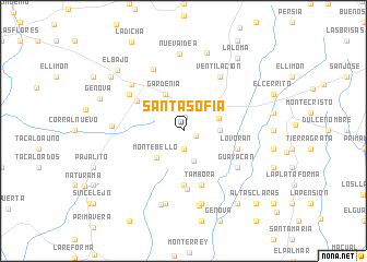
Santa Sofía (Magdalena, Colombia)Santa Sofía is a town in the Magdalena region of Colombia. An overview map of the region around Santa Sofía is displayed below.
regional and 3d topo map of Santa Sofía, Colombia ::
Santa Sofía airports ::
The nearest airport is MGN - Magangue Baracoa, located 72.6 km south west of Santa Sofía.
Other airports nearby include CZU - Corozal Las Brujas (107.6 km south west), BAQ - Barranquilla Ernesto Cortissoz (128.7 km north), CTG - Cartagena Rafael Nunez (140.5 km north west), VUP - Valledupar Alfonso Lopez Pumarejo (146.8 km north east), Nearby towns ::
Bruselas (1.3km east) //
La Estrella (1.4km north) //
Santo Eccehomo (1.9km south) //
Zulia (3.2km south) //
Nueva Granada (3.6km north east) //
Vistahermosa (3.7km east) //
San Antonio (3.8km east) //
Montebello (3.8km south west) //
Gardenia (4.1km north west) //
La Concepción (5.6km south) //
Costarrica (5.6km south) //
La María (5.5km north west) //
Lo Vorán (5.8km east) //
Tambora (5.9km south) //
Tierragrata (5.9km south) //
Guayacán (6.6km south east) //
Ventilación (6.7km north east) //
Puerto Colombia (6.6km north west) //
Concordia (7.0km north west) //
La Fortuna (7.1km north west) //
Santo Domingo (7.3km west) //
Puerto Colombia (7.6km south) //
Montevirgen (7.6km south) //
Granadilla (7.8km south) //
Santa Isabel (7.8km south) //
Nueva Idea (7.9km north) //
Corral Nuevo (8.3km north) //
El Bajo (9.0km north west) //
Génova (9.1km west) //
[all distances 'as the bird flies' and approximate] 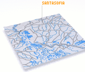 Places with similar names to Santa Sofía, Colombia ::
// Suntsovo (RU)
// Suntsovo (RU)
// Santa Sofia (BR)
// Zentsevo (RU)
// Zentsovo (RU)
// Zentsovo (RU)
// Zintsovo (RU)
// Santa Sofia (PT)
// Santa Sofía (CU)
// Santa Sofía (CU)
Disclaimer :: Information on this page comes without warranty of any kind |
||
|
Where is Santa Sofía? Elevation and coordinates ::
Latitude (lat): 9°47'0"N Longitude (lon): 74°25'0"W
Elevation (approx.): 129m (map arrows pan, magnifying glasses zoom) |
||
|
Visiting Santa Sofía? Hotel/Accommodation ::
Book a hotel in Santa Sofía Travel Guide ::
Buy a travel guide for Colombia rental cars ::
car rental offers GPS waypoint ::
download a GPX waypoint (PoI) of Santa Sofía for your GPS receiver
|
||