|
search place name
|
||
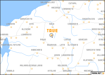
Taive (Atlántico, Colombia)Taive is a town in the Atlántico region of Colombia. An overview map of the region around Taive is displayed below.
regional and 3d topo map of Taive, Colombia ::
Taive airports ::
The nearest airport is BAQ - Barranquilla Ernesto Cortissoz, located 35.8 km north east of Taive.
Other airports nearby include CTG - Cartagena Rafael Nunez (59.1 km south west), SMR - Santa Marta Simon Bolivar (101.1 km north east), CZU - Corozal Las Brujas (160.1 km south), MGN - Magangue Baracoa (166.0 km south), Nearby towns ::
Piojó (3.6km south west) //
Saco (3.7km north) //
Aguaviva (3.7km south) //
Lata (5.2km south east) //
Luriza (5.8km east) //
Santa Ana (6.6km north west) //
Bajo de Unira (7.4km south) //
Unira (7.6km south) //
Arroyo Barro (7.6km south) //
Hibácharo (7.8km south west) //
Chorrera (8.2km north east) //
El Tesoro (8.2km south east) //
Vito (8.2km north west) //
Juan de Acosta (8.8km north east) //
El Valven (9.0km north east) //
La Serranía (9.2km south east) //
[all distances 'as the bird flies' and approximate] 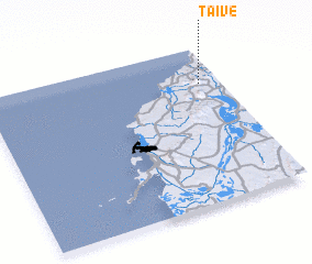 Places with similar names to Taive, Colombia ::
Disclaimer :: Information on this page comes without warranty of any kind |
||
|
Where is Taive? Elevation and coordinates ::
Latitude (lat): 10°46'0"N Longitude (lon): 75°5'0"W
Elevation (approx.): 121m (map arrows pan, magnifying glasses zoom) |
||
|
Visiting Taive? Hotel/Accommodation ::
Book a hotel in Taive Travel Guide ::
Buy a travel guide for Colombia rental cars ::
car rental offers GPS waypoint ::
download a GPX waypoint (PoI) of Taive for your GPS receiver
|
||