|
search place name
|
||
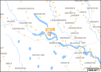
Uyua (Departamento de Casanare, Colombia)Uyua is a town in the Departamento de Casanare region of Colombia. An overview map of the region around Uyua is displayed below.
regional and 3d topo map of Uyua, Colombia ::
Uyua airports ::
The nearest airport is VVC - Villavicencio Vanguardia, located 154.4 km south west of Uyua.
Other airports nearby include TME - Tame (190.7 km north), BOG - Bogota Eldorado Intl (194.5 km west), Nearby towns ::
Valledupar (1.8km south west) //
La Pradera (1.8km east) //
Las Delicias (2.1km north west) //
Buenos Aires (2.1km south east) //
Las Gaviotas (2.2km west) //
Rincón Palmarito (2.6km north west) //
Boca Chica (3.7km west) //
San Antonio (4.1km south east) //
Haití (4.8km south east) //
La Providencia (4.9km east) //
Flor Amarillo (5.0km west) //
Los Algarrobos (5.6km north east) //
Mararabe (5.8km east) //
Rosa Blanca (5.9km west) //
Balmoral (6.1km north east) //
El Indostán (6.4km south east) //
Mirabonito (7.4km south east) //
San Agustín (7.4km east) //
La Siberia (7.6km north) //
La Graciela (7.8km north west) //
Vanguardia (8.2km north west) //
Guamito (8.3km north west) //
Paso Real (8.3km north east) //
Andalucía (8.5km north east) //
Canta Claro (9.4km south west) //
Santa Rita (10.5km north east) //
Buenaventura (10.8km north west) //
[all distances 'as the bird flies' and approximate] 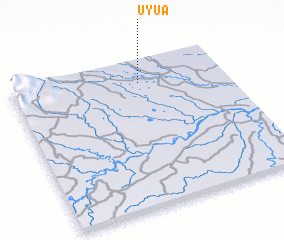 Places with similar names to Uyua, Colombia ::
Disclaimer :: Information on this page comes without warranty of any kind |
||
|
Where is Uyua? Elevation and coordinates ::
Latitude (lat): 4°51'0"N Longitude (lon): 72°24'0"W
Elevation (approx.): 190m (map arrows pan, magnifying glasses zoom) |
||
|
Visiting Uyua? Hotel/Accommodation ::
Book a hotel in Uyua Travel Guide ::
Buy a travel guide for Colombia rental cars ::
car rental offers GPS waypoint ::
download a GPX waypoint (PoI) of Uyua for your GPS receiver
|
||