|
search place name
|
||
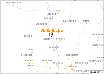
Versalles (Antioquia, Colombia)Versalles is a town in the Antioquia region of Colombia. An overview map of the region around Versalles is displayed below.
regional and 3d topo map of Versalles, Colombia ::
Versalles airports ::
The nearest airport is EOH - Medellin Olaya Herrera, located 62.2 km north east of Versalles.
Other airports nearby include MDE - Rio Negro Jose Maria Cordova (69.9 km north east), UIB - Quibdo El Carano (82.4 km west), MZL - Manizales La Nubia (93.1 km south east), PEI - Pereira Matecana (105.2 km south), Nearby towns ::
El Limón (1.1km north) //
Puerto Boy (1.9km north) //
La Libia (2.6km south west) //
Hoyo Grande (2.9km north east) //
San José (3.4km south east) //
El Bosque (4.8km south) //
San Joaquín (5.2km north west) //
Hispania (6.0km north) //
Sevilla (7.4km north) //
Las Marías (7.4km north) //
Pueblorrico (7.8km north east) //
Betania (8.7km west) //
Sinaí (8.9km north) //
Tapartó (9.1km south west) //
Alsacia (10.0km south east) //
Buenos Aires (10.3km south east) //
[all distances 'as the bird flies' and approximate] 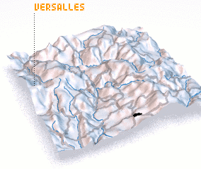 Places with similar names to Versalles, Colombia ::
// Versalles (BO)
// Versalles (BO)
// Versalles (BO)
// Versalles (BO)
// Versailles (US)
// Versailles (US)
// Versailles (US)
// Vrysoúles (GR)
// Varzielas (PT)
// Varzielas (PT)
Disclaimer :: Information on this page comes without warranty of any kind |
||
|
Where is Versalles? Elevation and coordinates ::
Latitude (lat): 5°45'0"N Longitude (lon): 75°54'0"W
Elevation (approx.): 1158m (map arrows pan, magnifying glasses zoom) |
||
|
Visiting Versalles? Hotel/Accommodation ::
Book a hotel in Versalles Travel Guide ::
Buy a travel guide for Colombia rental cars ::
car rental offers GPS waypoint ::
download a GPX waypoint (PoI) of Versalles for your GPS receiver
|
||