|
search place name
|
||
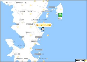
Ajangua (Comoros)Ajangua is a town in Comoros. An overview map of the region around Ajangua is displayed below.
regional and 3d topo map of Ajangua, Comoros ::
Ajangua airports ::
The nearest airport is DZA - Dzaoudzi Pamandzi, located 9.8 km north east of Ajangua.
Other airports nearby include AJN - Anjouan Ouani (118.0 km north west), NWA - Moheli Bandaressalam (169.7 km west), HAH - Moroni Prince Said Ibrahim (257.9 km north west), Nearby towns ::
Anguebacao (2.6km south east) //
Amoro (2.6km south east) //
Ironi Kely (3.7km north) //
Bandele (4.1km south west) //
Dembeni (5.2km north west) //
MʼSamouni (5.7km west) //
Ongoujou (5.7km west) //
Mirereni (6.6km south west) //
Passamenti (7.6km north) //
Mouramedoudou (9.2km south west) //
Combani (9.2km north west) //
Pamanzi Be (9.2km north east) //
[all distances 'as the bird flies' and approximate] 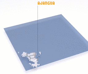 Places with similar names to Ajangua, Comoros ::
Disclaimer :: Information on this page comes without warranty of any kind |
||
|
Where is Ajangua? Elevation and coordinates ::
Latitude (lat): 12°52'0"S Longitude (lon): 45°13'0"E
Elevation (approx.): -32768m (map arrows pan, magnifying glasses zoom) |
||
|
Visiting Ajangua? Hotel/Accommodation ::
Book a hotel in Ajangua Travel Guide ::
Buy a travel guide for Comoros rental cars ::
car rental offers GPS waypoint ::
download a GPX waypoint (PoI) of Ajangua for your GPS receiver
|
||