|
search place name
|
||
Eata (Congo, Democratic Republic of the)Eata is a town in Congo, Democratic Republic of the. An overview map of the region around Eata is displayed below.
regional and 3d topo map of Eata, Congo, Democratic Republic of the ::
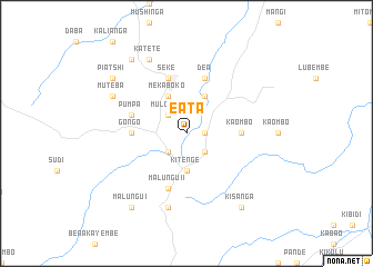
Nearby towns ::
Mindu (1.8km east) //
Katamba (1.8km east) //
Mulombo (2.6km north west) //
Lohahi (2.6km south west) //
Mutombo (2.6km south east) //
Kitenge (3.7km south) //
Kalende (4.1km north east) //
Mekaboko (4.1km north west) //
Kaombo (5.5km east) //
Gongo (5.5km west) //
Pumpa (5.8km west) //
Seke (5.9km north) //
Malungu II (5.9km south) //
Dea (5.9km north) //
Kidima (5.9km south) //
Katenta (7.6km south) //
Katete (8.3km north west) //
Muteba (8.3km north west) //
Elunga (9.3km north west) //
Piatshi (9.2km north west) //
Kisanga (9.3km south east) //
Malungu I (9.3km south west) //
[all distances 'as the bird flies' and approximate] 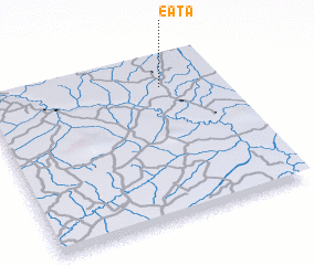 Places with similar names to Eata, Congo, Democratic Republic of the ::
Disclaimer :: Information on this page comes without warranty of any kind |
||
|
Where is Eata? Elevation and coordinates ::
Latitude (lat): 5°11'0"S Longitude (lon): 25°45'0"E
Elevation (approx.): 608m (map arrows pan, magnifying glasses zoom) |
||
|
Visiting Eata? Hotel/Accommodation ::
Book a hotel in Eata Travel Guide ::
rental cars ::
car rental offers GPS waypoint ::
download a GPX waypoint (PoI) of Eata for your GPS receiver
|
||