|
search place name
|
||
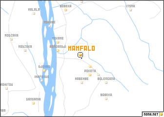
Mamfalo (Congo, Democratic Republic of the)Mamfalo is a town in Congo, Democratic Republic of the. An overview map of the region around Mamfalo is displayed below.
regional and 3d topo map of Mamfalo, Congo, Democratic Republic of the ::
Mamfalo airports ::
The nearest airport is MDK - Mbandaka, located 184.3 km south of Mamfalo.
Other airports nearby include GMA - Gemena (248.9 km north east), Nearby towns ::
Bibomba (2.6km south east) //
Pokota (4.1km south east) //
Mbundji (5.2km south east) //
Mabembe (5.6km south) //
Bongandji (5.9km west) //
Mokame (6.7km north west) //
Bolengana (7.9km south east) //
Djemba (9.1km west) //
Mokame (10.5km north west) //
[all distances 'as the bird flies' and approximate] 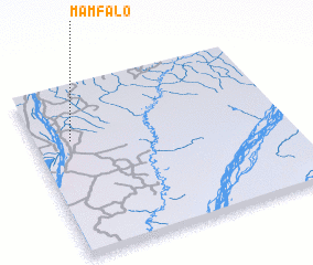 Places with similar names to Mamfalo, Congo, Democratic Republic of the ::
// Miami Valley (US)
// Miami Villa (US)
// Miamiville (US)
// Mamvoula (CF)
// Mimvoul (GA)
// Maimbeville (FR)
Disclaimer :: Information on this page comes without warranty of any kind |
||
|
Where is Mamfalo? Elevation and coordinates ::
Latitude (lat): 1°41'0"N Longitude (lon): 18°9'0"E
Elevation (approx.): 340m (map arrows pan, magnifying glasses zoom) |
||
|
Visiting Mamfalo? Hotel/Accommodation ::
Book a hotel in Mamfalo Travel Guide ::
rental cars ::
car rental offers GPS waypoint ::
download a GPX waypoint (PoI) of Mamfalo for your GPS receiver
|
||