|
search place name
|
||
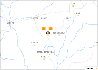
Pilipili (Congo, Democratic Republic of the)Pilipili is a town in Congo, Democratic Republic of the. An overview map of the region around Pilipili is displayed below.
regional and 3d topo map of Pilipili, Congo, Democratic Republic of the ::
Pilipili airports ::
The nearest airport is BUX - Bunia, located 54.1 km south east of Pilipili.
Nearby towns ::
Tshibi-Tshibi (3.7km east) //
Lodjo (5.9km north) //
Andisa (6.7km south west) //
Mongbwalu (7.4km south) //
Mabilindai (7.6km south) //
Djitofu (7.9km north west) //
Nzebi (8.3km south west) //
Loke (9.3km north east) //
[all distances 'as the bird flies' and approximate] 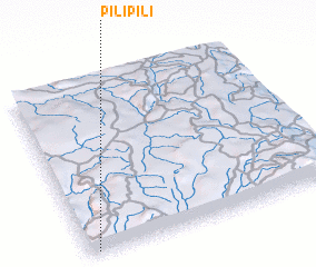 Places with similar names to Pilipili, Congo, Democratic Republic of the ::
// Pliopliai (LT)
// Pillapalu (EE)
// Plēpļi (LV)
// Plopul (RO)
// Pouloupoulou (BF)
// Palpal (CL)
// Pilipili (CD)
// Pole-Pole (CD)
// Pillipalli (IN)
// Pulapalli (IN)
Disclaimer :: Information on this page comes without warranty of any kind |
||
|
Where is Pilipili? Elevation and coordinates ::
Latitude (lat): 2°1'0"N Longitude (lon): 30°2'0"E
Elevation (approx.): 1272m (map arrows pan, magnifying glasses zoom) |
||
|
Visiting Pilipili? Hotel/Accommodation ::
Book a hotel in Pilipili Travel Guide ::
rental cars ::
car rental offers GPS waypoint ::
download a GPX waypoint (PoI) of Pilipili for your GPS receiver
|
||