|
search place name
|
||
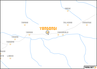
Yandondi (Congo, Democratic Republic of the)Yandondi is a town in Congo, Democratic Republic of the. An overview map of the region around Yandondi is displayed below.
regional and 3d topo map of Yandondi, Congo, Democratic Republic of the ::
Yandondi airports ::
The nearest airport is LIQ - Lisala, located 87.7 km south west of Yandondi.
Other airports nearby include BDT - Gbadolite (201.0 km north west), Nearby towns ::
Yaimba (3.7km east) //
Yamisakolo (5.6km east) //
Yapama (7.4km west) //
Yalikombi (8.3km north east) //
[all distances 'as the bird flies' and approximate] 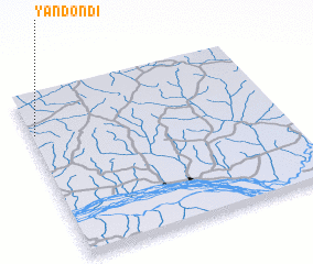 Places with similar names to Yandondi, Congo, Democratic Republic of the ::
Disclaimer :: Information on this page comes without warranty of any kind |
||
|
Where is Yandondi? Elevation and coordinates ::
Latitude (lat): 2°46'0"N Longitude (lon): 22°1'0"E
Elevation (approx.): 436m (map arrows pan, magnifying glasses zoom) |
||
|
Visiting Yandondi? Hotel/Accommodation ::
Book a hotel in Yandondi Travel Guide ::
rental cars ::
car rental offers GPS waypoint ::
download a GPX waypoint (PoI) of Yandondi for your GPS receiver
|
||