|
search place name
|
||
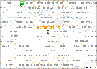
Arcángeles (San José, Costa Rica)Arcángeles is a town in the San José region of Costa Rica. An overview map of the region around Arcángeles is displayed below.
regional and 3d topo map of Arcángeles, Costa Rica ::
Arcángeles airports ::
The nearest airport is SJO - San Jose Juan Santamaria Intl, located 15.9 km north west of Arcángeles.
Other airports nearby include XQP - Quepos La Managua (48.7 km south), LIO - Limon Intl (120.3 km east), PMZ - Palmar Sur (125.3 km south east), NOB - Nosara Beach Nosara (168.8 km west), Nearby towns ::
San Antonio (0.0km north) //
Mesón (1.9km south) //
Torrotillo (1.9km north) //
La Verbena (1.9km north) //
Lámparas (1.8km east) //
Alto de Domingo Mora (1.8km east) //
Poás (2.6km south east) //
Aserrí (2.6km south east) //
La Masilla (2.6km north west) //
San Josecito (2.6km north east) //
San Felipe (2.6km north east) //
Alajuelita (2.6km north east) //
San Rafael Arriba (3.7km east) //
San Juan de Dios (3.7km east) //
Tejarcillos (3.7km north) //
El Llano (3.7km north) //
Peralta (3.7km north) //
Santa Teresa (3.7km north) //
Jaular (4.1km south west) //
Salitrillos (4.1km south east) //
Naranjo (4.1km north west) //
Chiverral (4.1km north west) //
Escazú (4.1km north west) //
San Antonio (4.1km north west) //
San Rafael Abajo (4.1km north east) //
Tejar (4.1km north east) //
Concepción (4.1km north east) //
La Verbena (4.1km north east) //
Hatillo (4.1km north east) //
[all distances 'as the bird flies' and approximate] 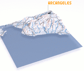 Places with similar names to Arcángeles, Costa Rica :: Disclaimer :: Information on this page comes without warranty of any kind |
||
|
Where is Arcángeles? Elevation and coordinates ::
Latitude (lat): 9°53'0"N Longitude (lon): 84°7'0"W
Elevation (approx.): 1470m (map arrows pan, magnifying glasses zoom) |
||
|
Visiting Arcángeles? Hotel/Accommodation ::
Book a hotel in Arcángeles Travel Guide ::
Buy a travel guide for Costa Rica rental cars ::
car rental offers GPS waypoint ::
download a GPX waypoint (PoI) of Arcángeles for your GPS receiver
|
||