|
search place name
|
||
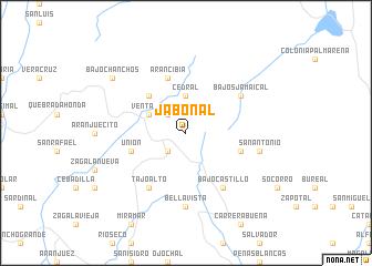
Jabonal (Puntarenas, Costa Rica)Jabonal is a town in the Puntarenas region of Costa Rica. An overview map of the region around Jabonal is displayed below.
regional and 3d topo map of Jabonal, Costa Rica ::
Jabonal airports ::
The nearest airport is SJO - San Jose Juan Santamaria Intl, located 56.1 km east of Jabonal.
Other airports nearby include XQP - Quepos La Managua (101.9 km south east), LIR - Liberia Daniel Oduber Quiros Intl (104.6 km north west), NOB - Nosara Beach Nosara (108.7 km west), LIO - Limon Intl (183.8 km east), Nearby towns ::
Zapotal (2.6km south west) //
Laguna (2.6km south west) //
Palmital (2.6km north west) //
Cedral (3.7km north) //
Ventanas (4.1km north west) //
Bajo Caliente (5.2km north west) //
Barranquilla (5.8km east) //
Unión (5.8km west) //
San Buenaventura (5.8km west) //
Arancibia (5.9km north) //
Bajo Castillo (6.7km south east) //
Bajos Jamaical (6.6km north east) //
Tajo Alto (6.7km south west) //
Bellavista (7.4km south) //
San Antonio (7.5km east) //
Bajo Chanchos (9.2km north west) //
[all distances 'as the bird flies' and approximate] 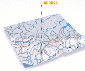
Disclaimer :: Information on this page comes without warranty of any kind |
||
|
Where is Jabonal? Elevation and coordinates ::
Latitude (lat): 10°11'0"N Longitude (lon): 84°41'0"W
Elevation (approx.): 1295m (map arrows pan, magnifying glasses zoom) |
||
|
Visiting Jabonal? Hotel/Accommodation ::
Book a hotel in Jabonal Travel Guide ::
Buy a travel guide for Costa Rica rental cars ::
car rental offers GPS waypoint ::
download a GPX waypoint (PoI) of Jabonal for your GPS receiver
|
||