|
search place name
|
||
Maicillal (Guanacaste, Costa Rica)Maicillal is a town in the Guanacaste region of Costa Rica. An overview map of the region around Maicillal is displayed below.
regional and 3d topo map of Maicillal, Costa Rica ::

Maicillal airports ::
The nearest airport is NOB - Nosara Beach Nosara, located 40.6 km west of Maicillal.
Other airports nearby include LIR - Liberia Daniel Oduber Quiros Intl (84.7 km north), SJO - San Jose Juan Santamaria Intl (120.5 km east), XQP - Quepos La Managua (136.7 km east), PMZ - Palmar Sur (225.2 km south east), Nearby towns ::
Ángeles (4.1km north east) //
Bejuco (4.1km south west) //
Millal (5.2km south east) //
Carrillo (5.2km south west) //
Jabilla (5.6km south) //
Quebrada Seca (5.8km west) //
Roncha (5.9km north) //
Porvenir (7.4km north) //
Jabilla (7.3km east) //
Corozalito (7.3km west) //
Río de Ora (7.8km north west) //
Bajo Moras (8.3km north east) //
Bella Vista (8.3km north east) //
San Francisco (9.2km south east) //
Candelillo (9.2km south east) //
Guabo (10.4km north east) //
[all distances 'as the bird flies' and approximate] 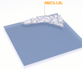 Places with similar names to Maicillal, Costa Rica ::
// Missellele (CM)
// Mazaolala (MG)
// Muz̧allalah (SA)
// Musalala (UG)
// Mselele (ZM)
// Msolola (ZM)
// Msololo (ZM)
// Musolela (ZM)
// Musolilo (ZM)
// Msalalo (TZ)
Disclaimer :: Information on this page comes without warranty of any kind |
||
|
Where is Maicillal? Elevation and coordinates ::
Latitude (lat): 9°52'0"N Longitude (lon): 85°18'0"W
Elevation (approx.): 183m (map arrows pan, magnifying glasses zoom) |
||
|
Visiting Maicillal? Hotel/Accommodation ::
Book a hotel in Maicillal Travel Guide ::
Buy a travel guide for Costa Rica rental cars ::
car rental offers GPS waypoint ::
download a GPX waypoint (PoI) of Maicillal for your GPS receiver
|
||