|
search place name
|
||
Hacienda Villaflores (Pichincha, Ecuador)Hacienda Villaflores is a town in the Pichincha region of Ecuador. An overview map of the region around Hacienda Villaflores is displayed below.
regional and 3d topo map of Hacienda Villaflores, Ecuador ::

Hacienda Villaflores airports ::
The nearest airport is UIO - Quito Mariscal Sucre Intl, located 10.2 km north of Hacienda Villaflores.
Other airports nearby include ATF - Ambato Chachoan (108.7 km south), TUA - Tulcan Teniente Coronel Luis A Mantilla (144.0 km north east), IPI - Ipiales San Luis (151.1 km north east), OCC - Coca Francisco De Orellana (168.5 km east), Nearby towns ::
Hacienda María (NaNkm north) //
Hacienda San Juanito (NaNkm north) //
Hacienda Verdecruz (1.9km north) //
Hacienda Monjas (1.9km north) //
La Foresta (1.9km north) //
Hacienda San Miguel (1.9km south) //
Hacienda Lonta (1.9km south) //
Hacienda San Antonio (1.9km west) //
Hacienda San José de Olaes (2.6km south east) //
Quito (2.6km north west) //
Hacienda San Francisco (2.6km south west) //
Guápulo (3.7km north) //
Alfaro (3.7km west) //
Hacienda Auquigrande (4.1km north east) //
Guangopolo (4.1km south east) //
Hacienda Cornejo (4.1km south east) //
Hacienda San Francisco Olaes (4.1km south east) //
Hacienda Cornejo de Ish (4.1km south west) //
Hacienda Chiriacu (4.1km south west) //
Hacienda Calzado (4.1km south west) //
Hacienda Siria (5.2km south east) //
Hacienda Clemencia (5.2km south west) //
Hacienda San Bartolo (5.2km south west) //
La Magdalena (5.6km west) //
Hacienda Carolina (5.6km north) //
Hacienda Batán Grande (5.6km north) //
Hacienda Auquichico (5.9km east) //
Hacienda Cunucyacu (5.9km east) //
Hacienda Rojas (5.9km east) //
[all distances 'as the bird flies' and approximate] 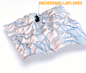 Places with similar names to Hacienda Villaflores, Ecuador :: Disclaimer :: Information on this page comes without warranty of any kind |
||
|
Where is Hacienda Villaflores? Elevation and coordinates ::
Latitude (lat): 0°14'0"S Longitude (lon): 78°29'0"W
Elevation (approx.): 2876m (map arrows pan, magnifying glasses zoom) |
||
|
Visiting Hacienda Villaflores? Hotel/Accommodation ::
Book a hotel in Hacienda Villaflores Travel Guide ::
Buy a travel guide for Ecuador rental cars ::
car rental offers GPS waypoint ::
download a GPX waypoint (PoI) of Hacienda Villaflores for your GPS receiver
|
||