|
search place name
|
||
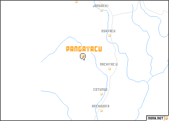
Pangayacu (Napo, Ecuador)Pangayacu is a town in the Napo region of Ecuador. An overview map of the region around Pangayacu is displayed below.
regional and 3d topo map of Pangayacu, Ecuador ::
Pangayacu airports ::
The nearest airport is ATF - Ambato Chachoan, located 93.4 km south west of Pangayacu.
Other airports nearby include OCC - Coca Francisco De Orellana (102.0 km north east), UIO - Quito Mariscal Sucre Intl (104.4 km north west), XMS - Macas Coronel E Carvajal (167.0 km south), TUA - Tulcan Teniente Coronel Luis A Mantilla (180.4 km north), Nearby towns ::
 Places with similar names to Pangayacu, Ecuador ::
// Paunggyok (MM)
// Pā'īn Kūyakh (IR)
Disclaimer :: Information on this page comes without warranty of any kind |
||
|
Where is Pangayacu? Elevation and coordinates ::
Latitude (lat): 0°49'0"S Longitude (lon): 77°50'0"W
Elevation (approx.): 1174m (map arrows pan, magnifying glasses zoom) |
||
|
Visiting Pangayacu? Hotel/Accommodation ::
Book a hotel in Pangayacu Travel Guide ::
Buy a travel guide for Ecuador rental cars ::
car rental offers GPS waypoint ::
download a GPX waypoint (PoI) of Pangayacu for your GPS receiver
|
||