|
search place name
|
||
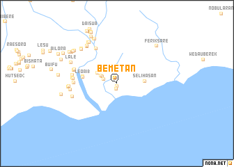
Bemetan (Timor Timur, East Timor)Bemetan is a town in the Timor Timur region of East Timor. An overview map of the region around Bemetan is displayed below.
regional and 3d topo map of Bemetan, East Timor ::
Bemetan airports ::
The nearest airport is DIL - Dili Presidente Nicolau Lobato Intl, located 71.0 km north of Bemetan.
Nearby towns ::
Bemetan (0.0km north east) //
Betano (0.5km south) //
Betano (0.9km south) //
Lalica (2.2km west) //
Lalica (2.2km west) //
Raifusa (2.5km north west) //
Raifusa (2.8km north west) //
Leoai (3.5km north west) //
Leoai 2 (3.6km north west) //
Selihasan (4.5km east) //
Leoai 1 (5.5km west) //
Leoai (5.5km west) //
Sesurai (6.5km north west) //
Sesurai (6.5km north west) //
Bobe (6.8km west) //
Bobe (6.8km west) //
Fatukabelak (7.0km west) //
Fatukabelak (7.1km west) //
Bemalai (7.1km west) //
Bemalai (7.1km west) //
Barialaran (7.2km west) //
Barialaran (7.2km west) //
Gulala (7.3km west) //
Gulala (7.4km west) //
Karsabar (7.4km west) //
Karsabar (7.5km west) //
Beko (7.6km north west) //
Beko (7.7km north west) //
Akariaran (7.7km west) //
[all distances 'as the bird flies' and approximate]  Places with similar names to Bemetan, East Timor ::
// Baumtown (US)
// Bamadan (CF)
// Buimetan (ID)
// Bomodin (GH)
// Bamideni (NE)
// Bemetan (ID)
// Bou Maadene (MA)
// Bame Town (LR)
// Baimatan (CN)
// Baimiaotan (CN)
Disclaimer :: Information on this page comes without warranty of any kind |
||
|
Where is Bemetan? Elevation and coordinates ::
Latitude (lat): 9°9'23"S Longitude (lon): 125°43'34"E
Elevation (approx.): 19m (map arrows pan, magnifying glasses zoom) |
||
|
Visiting Bemetan? Hotel/Accommodation ::
Book a hotel in Bemetan Travel Guide ::
Buy a travel guide for East Timor rental cars ::
car rental offers GPS waypoint ::
download a GPX waypoint (PoI) of Bemetan for your GPS receiver
|
||