|
search place name
|
||
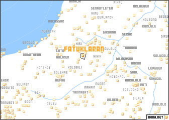
Fatuklaran (Timor Timur, East Timor)Fatuklaran is a town in the Timor Timur region of East Timor. An overview map of the region around Fatuklaran is displayed below.
regional and 3d topo map of Fatuklaran, East Timor ::
Fatuklaran airports ::
The nearest airport is DIL - Dili Presidente Nicolau Lobato Intl, located 71.7 km north east of Fatuklaran.
Nearby towns ::
Nalametan (1.2km west) //
Mohak (1.5km south east) //
Raihun (1.6km north) //
Oepauk (1.6km west) //
Ferikatuas (1.7km east) //
Fatululit (2.3km north west) //
Fatukuak (2.5km north) //
Minereng (2.5km north) //
Aube (2.6km north) //
Balibo (2.7km north west) //
Wiwik (2.8km east) //
Airae (2.8km north) //
Dadubere (2.9km north) //
Berame (3.0km north) //
Misi (3.0km north west) //
Falohai (3.0km south east) //
Besakren (3.2km south east) //
Remian (3.3km south) //
Kolobili (3.3km south west) //
Raiulun (3.4km south) //
Nuren (3.4km south) //
Beain (3.5km north) //
Fauk (3.5km north east) //
Bauwai (3.9km south west) //
Aitos (4.0km north) //
Fatukakae (4.1km north west) //
Ualeten (4.3km north east) //
Fatunisin (4.3km north) //
Beremanu (4.3km east) //
[all distances 'as the bird flies' and approximate] 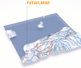 Places with similar names to Fatuklaran, East Timor ::
// Fatuklaran (TP)
Disclaimer :: Information on this page comes without warranty of any kind |
||
|
Where is Fatuklaran? Elevation and coordinates ::
Latitude (lat): 8°59'28"S Longitude (lon): 125°3'0"E
Elevation (approx.): 668m (map arrows pan, magnifying glasses zoom) |
||
|
Visiting Fatuklaran? Hotel/Accommodation ::
Book a hotel in Fatuklaran Travel Guide ::
Buy a travel guide for East Timor rental cars ::
car rental offers GPS waypoint ::
download a GPX waypoint (PoI) of Fatuklaran for your GPS receiver
|
||