|
search place name
|
||
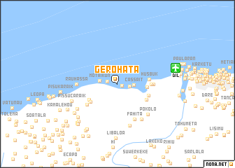
Gerohata (Timor Timur, East Timor)Gerohata is a town in the Timor Timur region of East Timor. An overview map of the region around Gerohata is displayed below.
regional and 3d topo map of Gerohata, East Timor ::
Gerohata airports ::
The nearest airport is DIL - Dili Presidente Nicolau Lobato Intl, located 9.6 km east of Gerohata.
Nearby towns ::
Kampungbaru (0.8km east) //
Kaitcho (1.7km west) //
Besite (1.9km east) //
Cassait (2.6km east) //
Motaikun (2.9km west) //
Kampungbaru (4.7km east) //
Husbuk (5.1km east) //
Mauluto (5.1km south west) //
Klaso (5.2km south west) //
Fatunia (5.2km east) //
Turlio (5.2km south east) //
Tibar (5.4km east) //
Libaulelo (5.7km east) //
Caimegi Ulu (5.9km south west) //
Fahita (6.3km south east) //
Rauhassa (6.5km west) //
Rihiu (6.9km south east) //
Pokolo (6.9km south east) //
Nasuto (6.9km south) //
Caimegi (7.5km south west) //
Pissucaraik (7.7km west) //
Leguimea (8.2km south west) //
Durubasa (8.2km south west) //
Libaloa (8.6km south) //
Metir (8.6km south west) //
Tuhilu Leten (8.7km south west) //
Bazartete (8.8km south west) //
Tuhilu Craic (8.9km south west) //
Bazartete (8.9km south west) //
[all distances 'as the bird flies' and approximate] 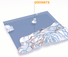 Places with similar names to Gerohata, East Timor ::
Disclaimer :: Information on this page comes without warranty of any kind |
||
|
Where is Gerohata? Elevation and coordinates ::
Latitude (lat): 8°34'10"S Longitude (lon): 125°26'26"E
Elevation (approx.): 7m (map arrows pan, magnifying glasses zoom) |
||
|
Visiting Gerohata? Hotel/Accommodation ::
Book a hotel in Gerohata Travel Guide ::
Buy a travel guide for East Timor rental cars ::
car rental offers GPS waypoint ::
download a GPX waypoint (PoI) of Gerohata for your GPS receiver
|
||