|
search place name
|
||
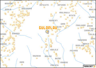
Gulorlau (Timor Timur, East Timor)Gulorlau is a town in the Timor Timur region of East Timor. An overview map of the region around Gulorlau is displayed below.
regional and 3d topo map of Gulorlau, East Timor ::
Gulorlau airports ::
The nearest airport is DIL - Dili Presidente Nicolau Lobato Intl, located 45.6 km north of Gulorlau.
Nearby towns ::
Hatumetaudo (0.8km south) //
Mantilu (1.5km east) //
Nonomogue (1.8km east) //
Sabagulau (2.1km south) //
Tukarocoiloco (2.2km north east) //
Mantelau (2.3km south east) //
Porema (2.8km south east) //
Kertapati (2.9km south) //
Nonomoguelao (3.1km east) //
Berluli (3.3km south) //
Leotelo (3.6km east) //
Leobutu (3.7km east) //
Mamurlau (3.8km south east) //
Maulore (4.1km south) //
Maulore (4.1km south) //
Lepulau (4.2km north east) //
Ainaro (4.3km south) //
Poelau (4.4km south) //
Soro (4.5km south) //
Sono (4.8km south) //
Monocati (4.8km north east) //
Sono (4.8km south) //
Terlora (4.9km south) //
Suruhati (4.8km north east) //
Terlora (4.9km south) //
Gerudu (5.0km south) //
Gerudu (5.1km south) //
Mauulo (5.1km south) //
Mauulo 1 (5.2km south) //
[all distances 'as the bird flies' and approximate]  Places with similar names to Gulorlau, East Timor ::
// Collaralli (IT)
// Calarillo (ES)
// Calle Real (SV)
// Calerilla (MX)
// Calle Real (MX)
// Kolarel (SD)
// Galrole (NG)
// Kalriāla (PK)
// Caleruela (ES)
// G‘allaorol (UZ)
Disclaimer :: Information on this page comes without warranty of any kind |
||
|
Where is Gulorlau? Elevation and coordinates ::
Latitude (lat): 8°57'30"S Longitude (lon): 125°30'29"E
Elevation (approx.): 1320m (map arrows pan, magnifying glasses zoom) |
||
|
Visiting Gulorlau? Hotel/Accommodation ::
Book a hotel in Gulorlau Travel Guide ::
Buy a travel guide for East Timor rental cars ::
car rental offers GPS waypoint ::
download a GPX waypoint (PoI) of Gulorlau for your GPS receiver
|
||