|
search place name
|
||
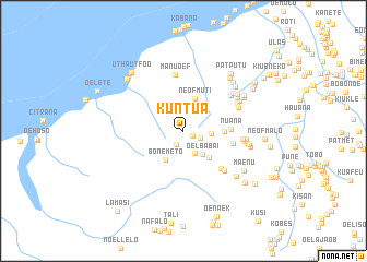
Kuntua (Timor Timur, East Timor)Kuntua is a town in the Timor Timur region of East Timor. An overview map of the region around Kuntua is displayed below.
regional and 3d topo map of Kuntua, East Timor ::
Kuntua airports ::
The nearest airport is DIL - Dili Presidente Nicolau Lobato Intl, located 168.1 km north east of Kuntua.
Nearby towns ::
Nítibe (1.0km south east) //
Oamna (1.5km south west) //
Taknebo (1.8km south east) //
Fatunababo (2.5km south east) //
Kiubukif (2.9km east) //
Oelbabai (3.0km south east) //
Bonemeto (3.5km south west) //
Neofmuti (3.5km north) //
Nefolete (3.8km south east) //
Isu (4.1km east) //
Nuana (4.8km east) //
Netensuan (5.1km east) //
Mahata (5.4km south east) //
Manuoef (5.8km north) //
Numatambing (5.8km south east) //
Bititim (6.0km north east) //
Oelpab (6.0km east) //
Numputu (6.1km north east) //
Neopnua (6.2km north east) //
Baokopael (6.3km east) //
Kanael (6.3km north east) //
Nuheo (6.4km north east) //
Kuanisi (6.4km east) //
Noahluku (6.5km north east) //
Aijauana (6.5km east) //
Poasbot (6.6km north east) //
Sonafjak (6.8km east) //
Kuapal (6.8km north east) //
Nemun (7.0km north east) //
[all distances 'as the bird flies' and approximate] 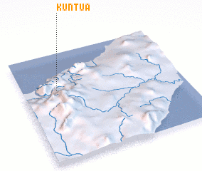 Places with similar names to Kuntua, East Timor ::
Disclaimer :: Information on this page comes without warranty of any kind |
||
|
Where is Kuntua? Elevation and coordinates ::
Latitude (lat): 9°20'15"S Longitude (lon): 124°13'10"E
Elevation (approx.): 756m (map arrows pan, magnifying glasses zoom) |
||
|
Visiting Kuntua? Hotel/Accommodation ::
Book a hotel in Kuntua Travel Guide ::
Buy a travel guide for East Timor rental cars ::
car rental offers GPS waypoint ::
download a GPX waypoint (PoI) of Kuntua for your GPS receiver
|
||