|
search place name
|
||
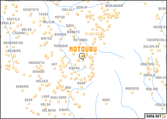
Motoubu (Timor Timur, East Timor)Motoubu is a town in the Timor Timur region of East Timor. An overview map of the region around Motoubu is displayed below.
regional and 3d topo map of Motoubu, East Timor ::
Motoubu airports ::
The nearest airport is DIL - Dili Presidente Nicolau Lobato Intl, located 50.6 km north of Motoubu.
Nearby towns ::
Atulara (0.3km south) //
Atubrau (0.4km north west) //
Lakubu (0.6km north east) //
Aiabe (0.7km north) //
Obeto (1.0km west) //
Nunumea (1.0km north east) //
Biliubu (1.3km west) //
Ataubu (1.3km north east) //
Waabe (1.3km north east) //
Taiubu (1.6km north east) //
Atolara (1.6km south) //
Airae (1.6km east) //
Dadubere (1.6km east) //
Batubala (1.9km east) //
Tapoabe (2.0km east) //
Manonia (2.1km south east) //
Mania (2.1km east) //
Suriubu (2.2km south west) //
Colimau (2.3km south east) //
Batueru (2.3km north) //
Maliubu (2.4km south east) //
Marobo (2.5km north west) //
Batumano (2.9km north) //
Biamoas (3.0km south east) //
Biahoro (3.0km north east) //
Batuu (3.3km north) //
Biabusi (3.4km west) //
Maliubu (3.4km south east) //
Aiaras (3.5km south west) //
[all distances 'as the bird flies' and approximate] 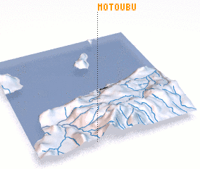 Places with similar names to Motoubu, East Timor ::
Disclaimer :: Information on this page comes without warranty of any kind |
||
|
Where is Motoubu? Elevation and coordinates ::
Latitude (lat): 8°58'38"S Longitude (lon): 125°22'13"E
Elevation (approx.): 900m (map arrows pan, magnifying glasses zoom) |
||
|
Visiting Motoubu? Hotel/Accommodation ::
Book a hotel in Motoubu Travel Guide ::
Buy a travel guide for East Timor rental cars ::
car rental offers GPS waypoint ::
download a GPX waypoint (PoI) of Motoubu for your GPS receiver
|
||