|
search place name
|
||
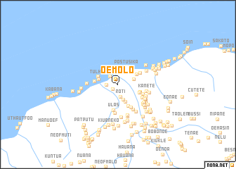
Oemolo (Timor Timur, East Timor)Oemolo is a town in the Timor Timur region of East Timor. An overview map of the region around Oemolo is displayed below.
regional and 3d topo map of Oemolo, East Timor ::
Oemolo airports ::
The nearest airport is DIL - Dili Presidente Nicolau Lobato Intl, located 153.2 km north east of Oemolo.
Nearby towns ::
Nepobai (1.1km south west) //
Lifau (1.7km north west) //
Tulaika (1.8km west) //
Roti (2.0km south) //
Kolam Cina (2.6km north) //
Semoro (2.6km east) //
Matanome (2.7km south) //
Jumati (3.0km south east) //
Postusika (3.1km north east) //
Taosero (3.1km west) //
Tulham (3.3km west) //
Fulolo (3.4km north east) //
Manunfena (3.7km east) //
Najalu (3.7km west) //
Fatusene (3.7km east) //
Biseo (3.8km south east) //
Masin (3.9km north east) //
Ulas (4.1km south) //
Sabela (4.3km south east) //
Nijamtasa (4.3km east) //
Padiae (4.4km south east) //
Nalaen (4.6km south) //
Nunenau (4.7km south east) //
Kanete (4.7km east) //
Oepoko (4.8km south east) //
Tumepat (4.9km south east) //
Tuinmolo (4.9km west) //
Nunbai (4.9km north east) //
Palink (5.0km south east) //
[all distances 'as the bird flies' and approximate] 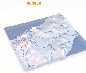 Places with similar names to Oemolo, East Timor ::
Disclaimer :: Information on this page comes without warranty of any kind |
||
|
Where is Oemolo? Elevation and coordinates ::
Latitude (lat): 9°13'38"S Longitude (lon): 124°18'41"E
Elevation (approx.): 27m (map arrows pan, magnifying glasses zoom) |
||
|
Visiting Oemolo? Hotel/Accommodation ::
Book a hotel in Oemolo Travel Guide ::
Buy a travel guide for East Timor rental cars ::
car rental offers GPS waypoint ::
download a GPX waypoint (PoI) of Oemolo for your GPS receiver
|
||