|
search place name
|
||
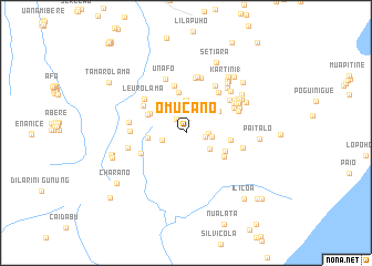
Omucano (Timor Timur, East Timor)Omucano is a town in the Timor Timur region of East Timor. An overview map of the region around Omucano is displayed below.
regional and 3d topo map of Omucano, East Timor ::
Omucano airports ::
The nearest airport is DIL - Dili Presidente Nicolau Lobato Intl, located 157.1 km west of Omucano.
Nearby towns ::
Nanacuro (1.7km north west) //
Maurotubuka (1.9km east) //
Chaiuacha Lama (2.3km east) //
Comilara (2.5km west) //
Vaurotubuka (2.7km east) //
Haitupuca (2.8km south east) //
Lauro (2.9km north) //
Nairete (3.3km north) //
Souro (3.3km north) //
Soro Kecil (3.4km north west) //
Sorolua (3.8km west) //
Chaiuacha Baru (4.0km north east) //
Leuro (4.0km north west) //
Caino (4.1km north) //
Luturula (4.2km north west) //
Lereloho (4.3km south east) //
Chomoco (4.5km east) //
Ililapa (4.5km south east) //
Chenuloro (4.9km north) //
Choquiro (5.0km south west) //
Soronaureci (5.0km north west) //
Laucepo Lama (5.2km north east) //
Leuro Lama (5.3km north west) //
Sawarika (5.4km north east) //
Natura (5.4km north east) //
Laucepo Baru (5.6km north east) //
Cacaven Lama (5.6km west) //
Larinacha (5.6km north) //
Sentral (5.6km north east) //
[all distances 'as the bird flies' and approximate] 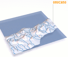
Disclaimer :: Information on this page comes without warranty of any kind |
||
|
Where is Omucano? Elevation and coordinates ::
Latitude (lat): 8°32'56"S Longitude (lon): 126°57'7"E
Elevation (approx.): 511m (map arrows pan, magnifying glasses zoom) |
||
|
Visiting Omucano? Hotel/Accommodation ::
Book a hotel in Omucano Travel Guide ::
Buy a travel guide for East Timor rental cars ::
car rental offers GPS waypoint ::
download a GPX waypoint (PoI) of Omucano for your GPS receiver
|
||