|
search place name
|
||
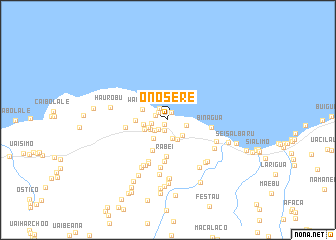
Onosere (Timor Timur, East Timor)Onosere is a town in the Timor Timur region of East Timor. An overview map of the region around Onosere is displayed below.
regional and 3d topo map of Onosere, East Timor ::
Onosere airports ::
The nearest airport is DIL - Dili Presidente Nicolau Lobato Intl, located 105.0 km west of Onosere.
Nearby towns ::
Kasmutu (0.6km south west) //
Uailabere (0.9km north) //
Caiobilalei (1.2km south) //
Racolo (1.4km north west) //
Diwake (1.5km west) //
Datawa (1.5km south west) //
Uatabo (1.6km north west) //
Teolale (1.8km west) //
Betulale (1.9km south west) //
Uaicainaro (2.1km south) //
Uaisarigo (2.1km east) //
Boile (2.2km south west) //
Makadai (2.3km west) //
Suliwa (2.4km south east) //
Luhadora (2.5km south east) //
Baucau (2.6km south west) //
Roulu (2.7km west) //
Anaulu (2.8km west) //
Waniuma (3.1km north west) //
Anawaro (3.5km west) //
Lutumutu (3.8km south west) //
Rabei (4.1km south) //
Latua (4.7km south) //
Uaineque (4.8km west) //
Binagua (4.9km east) //
Cailara (5.1km south west) //
Loidua (5.3km south west) //
Loidua (5.4km south) //
Uaimoribere (5.7km south west) //
[all distances 'as the bird flies' and approximate] 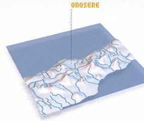 Places with similar names to Onosere, East Timor ::
Disclaimer :: Information on this page comes without warranty of any kind |
||
|
Where is Onosere? Elevation and coordinates ::
Latitude (lat): 8°27'10"S Longitude (lon): 126°28'24"E
Elevation (approx.): 192m (map arrows pan, magnifying glasses zoom) |
||
|
Visiting Onosere? Hotel/Accommodation ::
Book a hotel in Onosere Travel Guide ::
Buy a travel guide for East Timor rental cars ::
car rental offers GPS waypoint ::
download a GPX waypoint (PoI) of Onosere for your GPS receiver
|
||