|
search place name
|
||
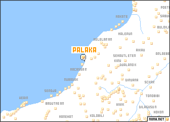
Palaka (Timor Timur, East Timor)Palaka is a town in the Timor Timur region of East Timor. An overview map of the region around Palaka is displayed below.
regional and 3d topo map of Palaka, East Timor ::
Palaka airports ::
The nearest airport is DIL - Dili Presidente Nicolau Lobato Intl, located 69.0 km north east of Palaka.
Nearby towns ::
Qima (0.9km south west) //
Oemarasi (1.4km east) //
Oeminak (2.3km east) //
Macassar (3.2km south west) //
Aimalai (3.4km north east) //
Subalesu (4.6km south east) //
Surpatin (5.1km south east) //
Maliaben (5.2km south east) //
Datolia (5.2km east) //
Kilibain (5.3km north east) //
Megir (5.3km north east) //
Tapo (5.4km south east) //
Melelaran (5.4km north east) //
Nubadak (5.9km south west) //
Boibun (6.0km south east) //
Biahian (5.9km north east) //
Taumrian (6.0km south east) //
Sukabelulik (6.1km south) //
Batugade (6.8km south west) //
Fatuteke (6.8km south east) //
Oetapo (6.9km east) //
Aumodok (7.3km south) //
Kiru (7.3km east) //
Halinsana (7.4km south west) //
Motamorak (7.6km south) //
Kolosuma (7.6km south) //
Malileten (7.6km south east) //
Fatukakae (7.7km south) //
Biae (8.1km south) //
[all distances 'as the bird flies' and approximate] 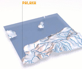 Places with similar names to Palaka, East Timor ::
Disclaimer :: Information on this page comes without warranty of any kind |
||
|
Where is Palaka? Elevation and coordinates ::
Latitude (lat): 8°53'43"S Longitude (lon): 125°0'16"E
Elevation (approx.): 9m (map arrows pan, magnifying glasses zoom) |
||
|
Visiting Palaka? Hotel/Accommodation ::
Book a hotel in Palaka Travel Guide ::
Buy a travel guide for East Timor rental cars ::
car rental offers GPS waypoint ::
download a GPX waypoint (PoI) of Palaka for your GPS receiver
|
||