|
search place name
|
||
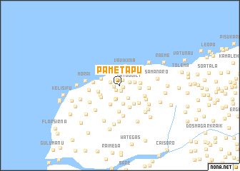
Pametapu (Timor Timur, East Timor)Pametapu is a town in the Timor Timur region of East Timor. An overview map of the region around Pametapu is displayed below.
regional and 3d topo map of Pametapu, East Timor ::
Pametapu airports ::
The nearest airport is DIL - Dili Presidente Nicolau Lobato Intl, located 37.3 km east of Pametapu.
Nearby towns ::
Lakmade (0.6km south east) //
Laklema (0.9km south) //
Pabalebu (0.9km north east) //
Nunuana (1.0km south west) //
Darulara (1.0km west) //
Lebumeta (1.5km west) //
Vatuguili (1.6km east) //
Nunulete (2.1km south) //
Baiquenilau (2.3km south east) //
Samanaro (2.3km south) //
Kemipu (2.3km east) //
Lisalara (2.9km south) //
Vavikinia (3.0km north) //
Lisalara (3.1km east) //
Maubara (3.2km north) //
Delusuvati (3.2km west) //
Lebulema (3.2km east) //
Lisalara (3.2km south west) //
Erito (3.4km south west) //
Raenaba (3.5km west) //
Lauvou (3.5km south west) //
Darulema (3.6km south east) //
Morae (3.6km north west) //
Kaikasa (3.7km south east) //
Darolema (4.0km south east) //
Kaikasa Vou (4.1km south) //
Bourawei (4.2km south east) //
Pukelete (4.2km west) //
Samanaro (4.5km east) //
[all distances 'as the bird flies' and approximate] 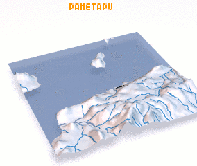 Places with similar names to Pametapu, East Timor :: Disclaimer :: Information on this page comes without warranty of any kind |
||
|
Where is Pametapu? Elevation and coordinates ::
Latitude (lat): 8°38'22"S Longitude (lon): 125°11'56"E
Elevation (approx.): 469m (map arrows pan, magnifying glasses zoom) |
||
|
Visiting Pametapu? Hotel/Accommodation ::
Book a hotel in Pametapu Travel Guide ::
Buy a travel guide for East Timor rental cars ::
car rental offers GPS waypoint ::
download a GPX waypoint (PoI) of Pametapu for your GPS receiver
|
||