|
search place name
|
||
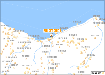
Suataici (Timor Timur, East Timor)Suataici is a town in the Timor Timur region of East Timor. An overview map of the region around Suataici is displayed below.
regional and 3d topo map of Suataici, East Timor ::
Suataici airports ::
The nearest airport is DIL - Dili Presidente Nicolau Lobato Intl, located 118.7 km west of Suataici.
Nearby towns ::
Soba (0.4km south west) //
Laga (0.4km west) //
Kotagama (0.7km north) //
Telibudae (0.9km south west) //
Bolobai (1.2km west) //
Samaguia (1.5km south west) //
Uarinana (1.6km south) //
Tekinomata (1.7km west) //
Kaikasalari (1.8km west) //
Natarici (2.0km north east) //
Aelemilari (2.2km south) //
Butofalo (2.5km south east) //
Couguira (3.0km south) //
Uassabolo (3.7km north east) //
Racolo (3.8km south west) //
Uacilava (3.8km east) //
Karanu (4.1km west) //
Saebere (4.1km west) //
Sialimo (4.2km west) //
Boleha (4.2km south east) //
Larifano (4.3km east) //
Gugulai (4.4km west) //
Mulia (4.4km west) //
Larigua (4.5km south west) //
Buiguira (4.8km north east) //
Gamana (4.9km west) //
Umarama (5.4km west) //
Borolau (5.5km east) //
Buskaulari (5.7km east) //
[all distances 'as the bird flies' and approximate] 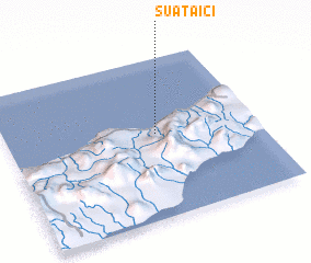 Places with similar names to Suataici, East Timor ::
// Sadies (MA)
// Sidi Aïssa (MA)
// Sidi Aïssa (MA)
// Sidi Aïssa (MA)
// Sidi Aïssa (MA)
// Sidi Aïssa (MA)
// Seytas (AZ)
// Satsa (MM)
// Satse (MM)
// Setzaw (MM)
Disclaimer :: Information on this page comes without warranty of any kind |
||
|
Where is Suataici? Elevation and coordinates ::
Latitude (lat): 8°28'20"S Longitude (lon): 126°36'1"E
Elevation (approx.): 45m (map arrows pan, magnifying glasses zoom) |
||
|
Visiting Suataici? Hotel/Accommodation ::
Book a hotel in Suataici Travel Guide ::
Buy a travel guide for East Timor rental cars ::
car rental offers GPS waypoint ::
download a GPX waypoint (PoI) of Suataici for your GPS receiver
|
||