|
search place name
|
||
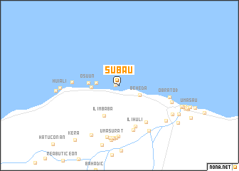
Subau (Timor Timur, East Timor)Subau is a town in the Timor Timur region of East Timor. An overview map of the region around Subau is displayed below.
regional and 3d topo map of Subau, East Timor ::
Subau airports ::
The nearest airport is DIL - Dili Presidente Nicolau Lobato Intl, located 44.5 km west of Subau.
Nearby towns ::
Beuah (0.6km west) //
Beheda (3.5km south east) //
Behau (3.7km west) //
Hau (4.4km west) //
Osuun (4.9km west) //
Ilimbaba (5.3km south west) //
Ilihuli (6.9km south) //
Condar (7.1km south east) //
Iun (7.3km south) //
Ilimano (7.3km west) //
Hahihoho (7.9km south) //
Obrato 1 (8.0km east) //
Nacaleu (8.2km south) //
Reododok (8.3km south) //
Umasurat (8.3km south) //
Laclo (8.4km south) //
Umanaruk (8.4km south) //
Rembor (8.4km south east) //
Hohorai (8.6km south) //
Obrato (8.6km east) //
Tahagamo (8.9km south west) //
Nunuli (9.1km south east) //
Malarahu (9.4km south east) //
Kera (11.0km south west) //
[all distances 'as the bird flies' and approximate]  Places with similar names to Subau, East Timor ::
Disclaimer :: Information on this page comes without warranty of any kind |
||
|
Where is Subau? Elevation and coordinates ::
Latitude (lat): 8°28'51"S Longitude (lon): 125°55'24"E
Elevation (approx.): 76m (map arrows pan, magnifying glasses zoom) |
||
|
Visiting Subau? Hotel/Accommodation ::
Book a hotel in Subau Travel Guide ::
Buy a travel guide for East Timor rental cars ::
car rental offers GPS waypoint ::
download a GPX waypoint (PoI) of Subau for your GPS receiver
|
||