|
search place name
|
||
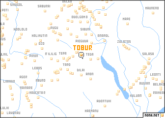
Tobur (Timor Timur, East Timor)Tobur is a town in the Timor Timur region of East Timor. An overview map of the region around Tobur is displayed below.
regional and 3d topo map of Tobur, East Timor ::
Tobur airports ::
The nearest airport is DIL - Dili Presidente Nicolau Lobato Intl, located 69.1 km north of Tobur.
Nearby towns ::
Teda (1.8km east) //
Zoilpo (2.0km north west) //
Zoilpo (2.0km north west) //
Oeceli (2.3km west) //
Ilhago (2.4km north) //
Omelat (2.9km north) //
Pieguda (2.9km north) //
Gudatas (2.9km west) //
Gulumugun (3.3km west) //
Gala (3.4km east) //
Tesigele (3.5km west) //
Dilai (3.6km south) //
Silagolo (4.0km south west) //
Lolo-Toi (4.1km south west) //
Loulolo (4.2km north east) //
Tapo (4.2km south west) //
Tepa (4.3km west) //
Anon (4.9km south) //
Mapeop (5.2km north) //
Ames (5.4km south west) //
Holak (5.6km west) //
Sibuni (5.7km north) //
Holmeser (5.9km north) //
Holbese (6.2km north west) //
Raimea (6.2km south west) //
Moko (6.3km south west) //
Anapol (6.5km north east) //
Boutal (6.7km south west) //
Lolotoe (6.7km south west) //
[all distances 'as the bird flies' and approximate] 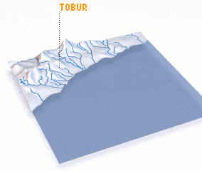 Places with similar names to Tobur, East Timor ::
Disclaimer :: Information on this page comes without warranty of any kind |
||
|
Where is Tobur? Elevation and coordinates ::
Latitude (lat): 9°8'18"S Longitude (lon): 125°19'28"E
Elevation (approx.): 614m (map arrows pan, magnifying glasses zoom) |
||
|
Visiting Tobur? Hotel/Accommodation ::
Book a hotel in Tobur Travel Guide ::
Buy a travel guide for East Timor rental cars ::
car rental offers GPS waypoint ::
download a GPX waypoint (PoI) of Tobur for your GPS receiver
|
||