|
search place name
|
||
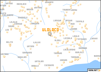
Ulolaco (Timor Timur, East Timor)Ulolaco is a town in the Timor Timur region of East Timor. An overview map of the region around Ulolaco is displayed below.
regional and 3d topo map of Ulolaco, East Timor ::
Ulolaco airports ::
The nearest airport is DIL - Dili Presidente Nicolau Lobato Intl, located 120.8 km west of Ulolaco.
Nearby towns ::
Samalari (0.3km north) //
Lacolu (0.5km east) //
Uaimata (0.6km north west) //
Salai (1.1km north) //
Afaloicai (1.4km north west) //
Locohu (1.6km east) //
Locohu (1.8km north east) //
Ossohuna (1.9km north) //
Ossomali (2.0km east) //
Caiualita (2.1km north east) //
Ossohuna (2.1km north east) //
Marae (3.0km north east) //
Haeconi (3.0km north east) //
Uaicai (3.1km south) //
Bacarui (3.2km north east) //
Uaniuma (3.6km south east) //
Uatobita (3.6km east) //
Liabuta (3.7km east) //
Alooli (3.7km south east) //
Builicorae (4.3km north east) //
Docoate (4.4km south east) //
Bahatata (4.4km north east) //
Bahatata (4.6km north east) //
Malulai (4.6km north east) //
Namanei (4.7km north east) //
Tetumori (4.7km east) //
Beheissi (4.8km north east) //
Tatadere (4.9km east) //
Samalari (5.0km north east) //
[all distances 'as the bird flies' and approximate] 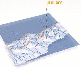 Places with similar names to Ulolaco, East Timor ::
// Ualeleca (MZ)
Disclaimer :: Information on this page comes without warranty of any kind |
||
|
Where is Ulolaco? Elevation and coordinates ::
Latitude (lat): 8°40'11"S Longitude (lon): 126°36'55"E
Elevation (approx.): 915m (map arrows pan, magnifying glasses zoom) |
||
|
Visiting Ulolaco? Hotel/Accommodation ::
Book a hotel in Ulolaco Travel Guide ::
Buy a travel guide for East Timor rental cars ::
car rental offers GPS waypoint ::
download a GPX waypoint (PoI) of Ulolaco for your GPS receiver
|
||