|
search place name
|
||
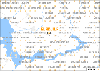
Guarjila (Chalatenango, El Salvador)Guarjila is a town in the Chalatenango region of El Salvador. An overview map of the region around Guarjila is displayed below.
regional and 3d topo map of Guarjila, El Salvador ::
Guarjila airports ::
The nearest airport is SAL - San Salvador El Salvador Intl, located 66.4 km south of Guarjila.
Other airports nearby include TGU - Tegucigalpa Toncontin Intl (180.0 km east), GUA - Guatemala City La Aurora (188.1 km west), SAP - San Pedro Sula La Mesa Intl (189.5 km north east), CBV - Coban (229.6 km north west), Nearby towns ::
Chiapas (1.9km north) //
El Mojón (1.8km east) //
Palo Verde (2.6km north east) //
Tepeyac (2.6km north west) //
La Montaña (2.6km south east) //
San Antonio Los Ranchos (2.6km south west) //
El Salitre (3.6km west) //
Alto El Sitio (3.7km south) //
Lagunita (4.0km north east) //
Las Limas (4.0km north east) //
Portillo del Norte (4.0km south east) //
San Isidro Labrador (4.0km south east) //
El Gramal (4.0km south west) //
Aldea Vieja (5.2km north east) //
San José Cancasque (5.2km south east) //
San Miguel de Mercedes (5.4km west) //
Pueblo Viejo (5.4km east) //
La Laguna (5.6km north) //
Chalatenango (5.7km west) //
Hacienda Vieja (5.7km east) //
Candelaria (5.8km south) //
El Sicahuital (5.7km east) //
Los Ortiz (5.8km north) //
Potonico (5.8km south) //
San José Las Flores (6.5km north east) //
Llano Verde (6.5km north east) //
Los Guardado (6.6km north east) //
Hacienda (6.6km north east) //
Potrerillos (6.6km south west) //
[all distances 'as the bird flies' and approximate]  Places with similar names to Guarjila, El Salvador ::
Disclaimer :: Information on this page comes without warranty of any kind |
||
|
Where is Guarjila? Elevation and coordinates ::
Latitude (lat): 14°1'0"N Longitude (lon): 88°53'0"W
Elevation (approx.): 560m (map arrows pan, magnifying glasses zoom) |
||
|
Visiting Guarjila? Hotel/Accommodation ::
Book a hotel in Guarjila Travel Guide ::
Buy a travel guide for El Salvador rental cars ::
car rental offers GPS waypoint ::
download a GPX waypoint (PoI) of Guarjila for your GPS receiver
|
||