|
search place name
|
||
San Sebastián La Zorra (La Paz, El Salvador)San Sebastián La Zorra is a town in the La Paz region of El Salvador. An overview map of the region around San Sebastián La Zorra is displayed below.
regional and 3d topo map of San Sebastián La Zorra, El Salvador ::

San Sebastián La Zorra airports ::
The nearest airport is SAL - San Salvador El Salvador Intl, located 23.7 km north west of San Sebastián La Zorra.
Other airports nearby include TGU - Tegucigalpa Toncontin Intl (195.7 km north east), GUA - Guatemala City La Aurora (226.6 km north west), Nearby towns ::
Guadalupe La Zorra (2.6km north west) //
La Calzada (3.6km west) //
Ánimas Abajo (3.7km north) //
Hacienda La Calzada (4.1km south west) //
San Sebastián El Chingo (4.1km north west) //
Azacualpa (4.1km north east) //
El Despoblado (5.2km north east) //
San Rafael Tasajera (5.6km south) //
El Zapote (6.6km south west) //
San José La Montaña (6.6km south east) //
El Escobal (7.4km west) //
Las Lomitas (7.6km north) //
Las Isletas (7.8km north east) //
Los Marranitos (8.1km north east) //
Las Mesas (9.1km south east) //
Agua Zarca (10.3km north east) //
[all distances 'as the bird flies' and approximate] 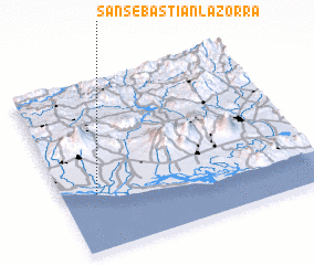 Places with similar names to San Sebastián La Zorra, El Salvador :: Disclaimer :: Information on this page comes without warranty of any kind |
||
|
Where is San Sebastián La Zorra? Elevation and coordinates ::
Latitude (lat): 13°20'0"N Longitude (lon): 88°52'0"W
Elevation (approx.): 3m (map arrows pan, magnifying glasses zoom) |
||
|
Visiting San Sebastián La Zorra? Hotel/Accommodation ::
Book a hotel in San Sebastián La Zorra Travel Guide ::
Buy a travel guide for El Salvador rental cars ::
car rental offers GPS waypoint ::
download a GPX waypoint (PoI) of San Sebastián La Zorra for your GPS receiver
|
||