|
search place name
|
||
Chuxil (Quiché, Guatemala)Chuxil is a town in the Quiché region of Guatemala. An overview map of the region around Chuxil is displayed below.
regional and 3d topo map of Chuxil, Guatemala ::

Chuxil airports ::
The nearest airport is GUA - Guatemala City La Aurora, located 52.8 km south east of Chuxil.
Other airports nearby include CBV - Coban (64.7 km north east), TAP - Tapachula Intl (174.0 km west), SAL - San Salvador El Salvador Intl (252.7 km south east), Nearby towns ::
Raxanep (1.8km west) //
La Vega (1.9km north) //
Talaxcoc (1.9km south) //
Quiacoj (1.9km north) //
Caquil (1.8km east) //
Chuaquenún (1.9km south) //
Ocós (2.6km south east) //
Sajcuín (4.1km south east) //
Joyabaj (4.3km west) //
Los Llanos (5.6km south) //
Pachalib (6.5km south west) //
Tanilar (6.5km south east) //
[all distances 'as the bird flies' and approximate] 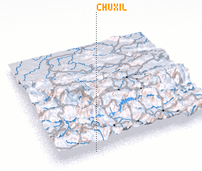 Places with similar names to Chuxil, Guatemala ::
// Shaykh Şāliḩ (IQ)
// Chak Saila (BD)
// Chacaicillo (CL)
// Shakazalo (CD)
// Chikusela (ZM)
// Sheykhsīlū (IR)
// Chaccella (PE)
// Chuksal-li (KP)
// Chuksal-li (KP)
// Chigasil (KR)
Disclaimer :: Information on this page comes without warranty of any kind |
||
|
Where is Chuxil? Elevation and coordinates ::
Latitude (lat): 15°0'0"N Longitude (lon): 90°46'0"W
Elevation (approx.): 1324m (map arrows pan, magnifying glasses zoom) |
||
|
Visiting Chuxil? Hotel/Accommodation ::
Book a hotel in Chuxil Travel Guide ::
Buy a travel guide for Guatemala rental cars ::
car rental offers GPS waypoint ::
download a GPX waypoint (PoI) of Chuxil for your GPS receiver
|
||