|
search place name
|
||
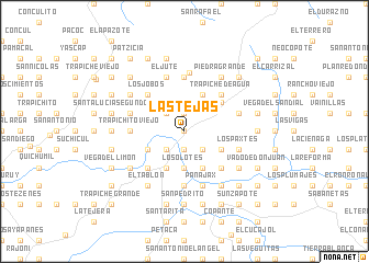
Las Tejas (Baja Verapaz, Guatemala)Las Tejas is a town in the Baja Verapaz region of Guatemala. An overview map of the region around Las Tejas is displayed below.
regional and 3d topo map of Las Tejas, Guatemala ::
Las Tejas airports ::
The nearest airport is GUA - Guatemala City La Aurora, located 39.4 km south of Las Tejas.
Other airports nearby include CBV - Coban (61.1 km north), TAP - Tapachula Intl (212.4 km west), SAL - San Salvador El Salvador Intl (218.4 km south east), Nearby towns ::
Agua Caliente (0.0km north) //
San Jacinto (1.9km north) //
El Zapote (1.9km north) //
La Canoa (1.9km south) //
El Anono (2.6km north west) //
Chivac (2.6km north west) //
El Limón (2.6km south west) //
Santa Catarina (2.6km south west) //
El Terrero (2.6km south east) //
El Zapotillo (2.6km south east) //
Los Encuentros (3.7km south) //
Los Olotes (3.7km south) //
San Buenaventura (4.0km south west) //
Las Cureñas (4.1km north east) //
Estancia Grande (4.0km south east) //
El Salitre (4.1km south west) //
El Jute (4.1km south east) //
El Amate (4.1km south east) //
Llano Grande (4.6km north east) //
Los Jobos (5.2km north west) //
Trapiche de Agua (5.2km north east) //
Los Ángeles (5.2km north east) //
San Bernardo (5.2km south west) //
Las Tintas (5.2km south east) //
Las Piedras (5.2km south east) //
Trapichito Viejo (5.4km west) //
El Quequexcal (5.6km north) //
Los Choyes (5.6km south) //
Las Vainillas (5.7km west) //
[all distances 'as the bird flies' and approximate] 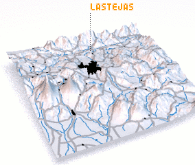 Places with similar names to Las Tejas, Guatemala ::
Disclaimer :: Information on this page comes without warranty of any kind |
||
|
Where is Las Tejas? Elevation and coordinates ::
Latitude (lat): 14°55'0"N Longitude (lon): 90°24'0"W
Elevation (approx.): 511m (map arrows pan, magnifying glasses zoom) |
||
|
Visiting Las Tejas? Hotel/Accommodation ::
Book a hotel in Las Tejas Travel Guide ::
Buy a travel guide for Guatemala rental cars ::
car rental offers GPS waypoint ::
download a GPX waypoint (PoI) of Las Tejas for your GPS receiver
|
||