|
search place name
|
||
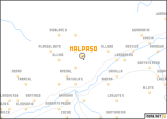
Mal Paso (Zacapa, Guatemala)Mal Paso is a town in the Zacapa region of Guatemala. An overview map of the region around Mal Paso is displayed below.
regional and 3d topo map of Mal Paso, Guatemala ::
Mal Paso airports ::
The nearest airport is CBV - Coban, located 117.8 km west of Mal Paso.
Other airports nearby include GUA - Guatemala City La Aurora (143.0 km south west), SAP - San Pedro Sula La Mesa Intl (156.1 km east), SAL - San Salvador El Salvador Intl (195.4 km south), TEA - Tela (211.5 km east), Nearby towns ::
Juan Ponce (2.6km south west) //
Cuchilla (2.6km north east) //
Guayabal (2.6km north west) //
Arenal (5.2km south west) //
El Limo (5.4km west) //
El Lobo (5.7km east) //
Mayuelas (5.8km south) //
Gualán (5.8km south) //
El Guamil (5.8km north) //
Encinitos (7.2km east) //
Plan del Bote (7.4km west) //
Biafra (7.7km south east) //
Los Achiotes (7.7km south west) //
Río Blanco (7.7km north west) //
Vainilla (8.1km south east) //
[all distances 'as the bird flies' and approximate] 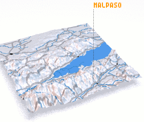 Places with similar names to Mal Paso, Guatemala ::
Disclaimer :: Information on this page comes without warranty of any kind |
||
|
Where is Mal Paso? Elevation and coordinates ::
Latitude (lat): 15°11'0"N Longitude (lon): 89°21'0"W
Elevation (approx.): 1023m (map arrows pan, magnifying glasses zoom) |
||
|
Visiting Mal Paso? Hotel/Accommodation ::
Book a hotel in Mal Paso Travel Guide ::
Buy a travel guide for Guatemala rental cars ::
car rental offers GPS waypoint ::
download a GPX waypoint (PoI) of Mal Paso for your GPS receiver
|
||