|
search place name
|
||
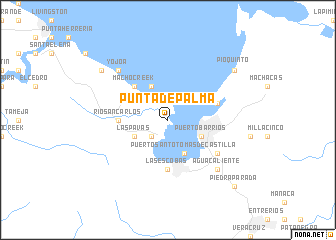
Punta de Palma (Izabal, Guatemala)Punta de Palma is a town in the Izabal region of Guatemala. An overview map of the region around Punta de Palma is displayed below.
regional and 3d topo map of Punta de Palma, Guatemala ::
Punta de Palma airports ::
The nearest airport is SAP - San Pedro Sula La Mesa Intl, located 82.2 km east of Punta de Palma.
Other airports nearby include TEA - Tela (124.1 km east), LCE - La Ceiba Goloson Intl (190.8 km east), CBV - Coban (192.4 km west), BZE - Belize City Philip S W Goldson Intl (202.8 km north), Nearby towns ::
La Romana (2.6km south west) //
La Esperanza (2.6km south west) //
Puerto Santo Tomás de Castilla (4.1km south east) //
Puerto Barrios (4.0km south east) //
Las Pavas (4.0km south west) //
El Paraíso (4.1km north west) //
Macho Creek (5.1km north west) //
Río San Carlos (5.4km west) //
Las Escobas (5.6km south) //
Río Pichilingo (5.7km east) //
San Manuel (6.5km south east) //
Yojoa (7.7km north west) //
Santa María (7.7km north west) //
Agua Caliente (7.7km south east) //
Pioquinto (9.0km north east) //
Baltimore (9.0km north west) //
Piedra Parada (10.3km south east) //
[all distances 'as the bird flies' and approximate] 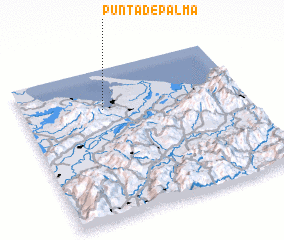 Places with similar names to Punta de Palma, Guatemala :: Disclaimer :: Information on this page comes without warranty of any kind |
||
|
Where is Punta de Palma? Elevation and coordinates ::
Latitude (lat): 15°44'0"N Longitude (lon): 88°38'0"W
Elevation (approx.): 11m (map arrows pan, magnifying glasses zoom) |
||
|
Visiting Punta de Palma? Hotel/Accommodation ::
Book a hotel in Punta de Palma Travel Guide ::
Buy a travel guide for Guatemala rental cars ::
car rental offers GPS waypoint ::
download a GPX waypoint (PoI) of Punta de Palma for your GPS receiver
|
||