|
search place name
|
||
Bongulūr (Andhra Pradesh, India)Bongulūr is a town in the Andhra Pradesh region of India. An overview map of the region around Bongulūr is displayed below.
regional and 3d topo map of Bongulūr, India ::

Bongulūr airports ::
The nearest airport is HYD - Hyderabad, located 27.3 km north west of Bongulūr.
Nearby towns ::
Mangalpalli (2.7km south east) //
Manigūdem (3.1km north east) //
Ādibatla (3.7km west) //
Yamjāl (4.4km north) //
Kongārkala (4.4km south west) //
Seriguda (4.8km east) //
Chenduguda (5.6km south west) //
Rāmdāspalli (5.6km east) //
Bahmanlapalli (5.9km north east) //
Upparguda (6.0km south east) //
Nāgargūl (6.1km north west) //
Pochāram (6.4km south east) //
Guramguda (7.3km north) //
Kongara (7.2km west) //
Rāwirāl (7.3km west) //
Tarūr (7.6km north east) //
Amjapur (8.2km north) //
Jannaiguda (8.1km south west) //
Koheda (8.3km north east) //
Ibrāhīmpatan (8.6km south east) //
Patelguda (9.1km south east) //
Khānāpur (10.1km south east) //
Saraswatiguda (10.7km south west) //
[all distances 'as the bird flies' and approximate] 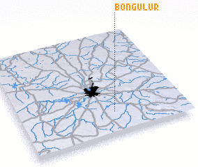 Places with similar names to Bongulūr, India ::
// Bunaklar (TR)
// Bonnie Claire (US)
// Benclare (US)
// Bankilaré (NE)
// Banga Luri (NG)
// Bangalore (IN)
// Ban Ngol Ré (VN)
// Bancalari (AR)
// Bunglar (GW)
Disclaimer :: Information on this page comes without warranty of any kind |
||
|
Where is Bongulūr? Elevation and coordinates ::
Latitude (lat): 17°13'48"N Longitude (lon): 78°34'41"E
Elevation (approx.): 549m (map arrows pan, magnifying glasses zoom) |
||
|
Visiting Bongulūr? Hotel/Accommodation ::
Book a hotel in Bongulūr Travel Guide ::
Buy a travel guide for India rental cars ::
car rental offers GPS waypoint ::
download a GPX waypoint (PoI) of Bongulūr for your GPS receiver
|
||