|
search place name
|
||
Changomal (Andhra Pradesh, India)Changomal is a town in the Andhra Pradesh region of India. An overview map of the region around Changomal is displayed below.
regional and 3d topo map of Changomal, India ::

Changomal airports ::
The nearest airport is HYD - Hyderabad, located 51.6 km north east of Changomal.
Nearby towns ::
Māmadpalli (2.7km south east) //
Timmāpur (2.9km west) //
Medalli (3.1km south west) //
Chittampalli (3.5km north) //
Khāndlāpalli (4.0km north) //
Kadmūr (4.1km south) //
Deorampalli (4.6km east) //
Khānāpur (5.0km north east) //
Kankal (6.3km south) //
Pudgurti (7.5km south) //
Tirmalāpur (7.3km south east) //
Meddāgudam (7.6km north east) //
Channaballi (7.5km east) //
Antāram (8.0km north) //
Babūlgaon (8.3km south east) //
Ālūr (9.4km north east) //
Chilkamāri (9.6km south east) //
Galūrguda (10.5km south east) //
[all distances 'as the bird flies' and approximate] 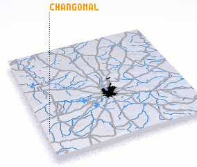 Places with similar names to Changomal, India ::
// Chhanni Kamāl (IN)
// Shinkai Mela (PK)
// Ch'ang-mal (KP)
// Ch'angmal (KP)
// Ch'angmal (KP)
// Changmul-li (KP)
// Chŏnggumal (KP)
// Chŏngmul-li (KP)
// Chung-mal (KP)
// Chung-mal (KP)
Disclaimer :: Information on this page comes without warranty of any kind |
||
|
Where is Changomal? Elevation and coordinates ::
Latitude (lat): 17°15'24"N Longitude (lon): 78°1'38"E
Elevation (approx.): 620m (map arrows pan, magnifying glasses zoom) |
||
|
Visiting Changomal? Hotel/Accommodation ::
Book a hotel in Changomal Travel Guide ::
Buy a travel guide for India rental cars ::
car rental offers GPS waypoint ::
download a GPX waypoint (PoI) of Changomal for your GPS receiver
|
||