|
search place name
|
||
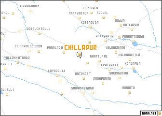
Chillāpur (Andhra Pradesh, India)Chillāpur is a town in the Andhra Pradesh region of India. An overview map of the region around Chillāpur is displayed below.
regional and 3d topo map of Chillāpur, India ::
Chillāpur airports ::
The nearest airport is HYD - Hyderabad, located 60.7 km north west of Chillāpur.
Other airports nearby include VGA - Vijayawada (212.6 km east), Nearby towns ::
Lachmagudam (1.9km south east) //
Wāilapall (2.6km north east) //
Āreguda (3.5km north east) //
Jangaon (4.1km north east) //
Paralagadda Tānda (3.9km west) //
Ghattupal (4.2km east) //
Antampet (4.8km south) //
Puttapāka (6.7km north east) //
Loyapalli (6.7km south west) //
Teratpalli (6.8km south east) //
Kudāsapalli (7.1km south west) //
Kottaguda (7.4km north) //
Nāmāpuram (7.6km south east) //
Shivannaguda (8.1km south) //
Yelmakanna (7.8km east) //
Indūrti (8.5km south) //
Lingamaniguda (9.0km north east) //
Elgapalli (9.2km south west) //
Sherigudam (9.6km south east) //
Chalmeda (9.7km north east) //
[all distances 'as the bird flies' and approximate] 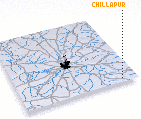 Places with similar names to Chillāpur, India ::
// Chāl-e Pīr (IR)
// Chālāpāra (BD)
// Chāliāpāra (BD)
// Chaluāpāra (BD)
// Chilupāra (BD)
// Sholapāra (BD)
// Siālipāra (BD)
// Chalpur (IN)
// Chillūpār (IN)
// Cholāpur (IN)
Disclaimer :: Information on this page comes without warranty of any kind |
||
|
Where is Chillāpur? Elevation and coordinates ::
Latitude (lat): 17°4'45"N Longitude (lon): 78°53'7"E
Elevation (approx.): 363m (map arrows pan, magnifying glasses zoom) |
||
|
Visiting Chillāpur? Hotel/Accommodation ::
Book a hotel in Chillāpur Travel Guide ::
Buy a travel guide for India rental cars ::
car rental offers GPS waypoint ::
download a GPX waypoint (PoI) of Chillāpur for your GPS receiver
|
||