|
search place name
|
||
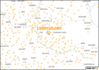
Chor Kunjiān (Jammu and Kashmīr, India)Chor Kunjiān is a town in the Jammu and Kashmīr region of India. An overview map of the region around Chor Kunjiān is displayed below.
regional and 3d topo map of Chor Kunjiān, India ::
Chor Kunjiān airports ::
The nearest airport is MFG - Muzaffarabad, located 31.5 km west of Chor Kunjiān.
Other airports nearby include RAZ - Rawala Kot Rawalakot (56.3 km south), SXR - Srinagar (94.5 km south east), ISB - Islamabad Chaklala (107.4 km south west), SDT - Saidu Sharif (146.5 km west), Nearby towns ::
Nawa Gabra (0.8km north) //
Kopra (0.9km east) //
Kundlān (1.1km north) //
Haftān (1.4km north) //
Hajītara (1.4km south west) //
Sari (1.6km south east) //
Magri Gali (1.6km south east) //
Bhandārs (2.0km south west) //
Batarāsi (2.4km south) //
Wānjal (2.7km south) //
Jabri (2.6km south east) //
Tad (2.6km west) //
Ghāsla (3.0km south) //
Chanpura Bāla (3.0km north west) //
Dhanni (2.7km west) //
Gowāji (3.2km south east) //
Treboni (3.2km north west) //
Buildhār (3.3km south east) //
Amrui (3.1km west) //
Batliān (3.7km south) //
Khorpāra (3.9km north) //
Jabri (3.6km north east) //
Sudpura (3.4km south west) //
Chanpura Pāīn (3.4km north west) //
Uohhan (3.4km south east) //
Chham Pathra (3.3km east) //
Bachrūta (4.0km south) //
Danna Bijildhār (3.6km south east) //
Hola (4.1km south) //
[all distances 'as the bird flies' and approximate]  Places with similar names to Chor Kunjiān, India :: Disclaimer :: Information on this page comes without warranty of any kind |
||
|
Where is Chor Kunjiān? Elevation and coordinates ::
Latitude (lat): 34°21'20"N Longitude (lon): 73°51'0"E
Elevation (approx.): 2159m (map arrows pan, magnifying glasses zoom) |
||
|
Visiting Chor Kunjiān? Hotel/Accommodation ::
Book a hotel in Chor Kunjiān Travel Guide ::
Buy a travel guide for India rental cars ::
car rental offers GPS waypoint ::
download a GPX waypoint (PoI) of Chor Kunjiān for your GPS receiver
|
||