|
search place name
|
||
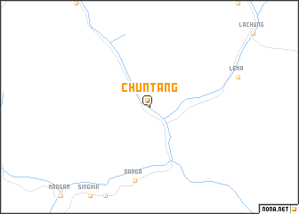
Chuntang (India)Chuntang is a town in India. An overview map of the region around Chuntang is displayed below.
regional and 3d topo map of Chuntang, India ::
Chuntang airports ::
The nearest airport is PBH - Paro, located 81.7 km east of Chuntang.
Other airports nearby include IXB - Baghdogra Bagdogra (108.0 km south), COH - Cooch-behar Cooch Behar (164.8 km south east), BIR - Biratnagar (185.1 km south west), SPD - Saidpur (207.6 km south), Nearby towns ::
[all distances 'as the bird flies' and approximate]  Places with similar names to Chuntang, India ::
// Shandaung (MM)
// Shantaung (MM)
// Shantaungu (MM)
// Shanting (MM)
// Sheing Htang (MM)
// Chantung (GH)
// Chandanke (PK)
// Chain-dong (KP)
// Ch'angho-dong (KP)
// Ch'anghu-dong (KP)
Disclaimer :: Information on this page comes without warranty of any kind |
||
|
Where is Chuntang? Elevation and coordinates ::
Latitude (lat): 27°37'0"N Longitude (lon): 88°38'0"E
Elevation (approx.): 1969m (map arrows pan, magnifying glasses zoom) |
||
|
Visiting Chuntang? Hotel/Accommodation ::
Book a hotel in Chuntang Travel Guide ::
Buy a travel guide for India rental cars ::
car rental offers GPS waypoint ::
download a GPX waypoint (PoI) of Chuntang for your GPS receiver
|
||