|
search place name
|
||
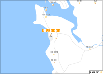
Diveāgar (Mahārāshtra, India)Diveāgar is a town in the Mahārāshtra region of India. An overview map of the region around Diveāgar is displayed below.
regional and 3d topo map of Diveāgar, India ::
Diveāgar airports ::
The nearest airport is BOM - Bombay Chhatrapati Shivaji Intl, located 102.2 km north of Diveāgar.
Other airports nearby include PNQ - Pune (108.0 km north east), ISK - Nasik Road (216.0 km north east), KLH - Kolhapur (216.5 km south east), Nearby towns ::
Agar Panchaitan (0.8km north) //
Borlai Panchaitan (1.7km east) //
Khujāre (6.4km south) //
Kudgaon (7.4km north) //
[all distances 'as the bird flies' and approximate] 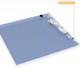 Places with similar names to Diveāgar, India ::
// Tavoy Gora (RU)
// Devaqueira (PT)
// Tifoukourou (BF)
// Devgarh (IN)
// Devgarh (IN)
// Devgarh (IN)
// Tafa Kouara (NE)
// Devīgarh (PK)
// Devigarh (PK)
// Difekir (NG)
Disclaimer :: Information on this page comes without warranty of any kind |
||
|
Where is Diveāgar? Elevation and coordinates ::
Latitude (lat): 18°10'24"N Longitude (lon): 72°59'30"E
Elevation (approx.): 2m (map arrows pan, magnifying glasses zoom) |
||
|
Visiting Diveāgar? Hotel/Accommodation ::
Book a hotel in Diveāgar Travel Guide ::
Buy a travel guide for India rental cars ::
car rental offers GPS waypoint ::
download a GPX waypoint (PoI) of Diveāgar for your GPS receiver
|
||