|
search place name
|
||
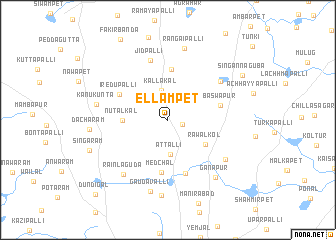
Ellampet (Andhra Pradesh, India)Ellampet is a town in the Andhra Pradesh region of India. An overview map of the region around Ellampet is displayed below.
regional and 3d topo map of Ellampet, India ::
Ellampet airports ::
The nearest airport is HYD - Hyderabad, located 25.5 km south of Ellampet.
Nearby towns ::
Somāram (1.6km east) //
Kallakal (3.4km north) //
Attalli (3.9km south) //
Rāwalkol (4.8km south east) //
Nutalkal (4.9km west) //
Muppireddipalli (5.6km north) //
Medchal (5.9km south) //
Baswapur (5.8km east) //
Iredupalli (5.9km north west) //
Kishtāpur (6.2km south) //
Jīdpalli (6.9km north) //
Kokunda (7.1km north east) //
Akhārjapet (7.5km south east) //
Rainlāguda (7.8km south west) //
Kānukunta (7.8km west) //
Gaudavalli (8.2km south) //
Rangaipalli (8.2km north) //
Ganāpur (8.2km south east) //
Sutāguda (8.4km south) //
Dāchāram (8.4km west) //
Singāram (9.0km south west) //
Singannaguba (9.4km north east) //
Dundigal (11.3km south west) //
[all distances 'as the bird flies' and approximate] 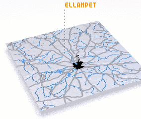
Disclaimer :: Information on this page comes without warranty of any kind |
||
|
Where is Ellampet? Elevation and coordinates ::
Latitude (lat): 17°40'58"N Longitude (lon): 78°29'18"E
Elevation (approx.): 608m (map arrows pan, magnifying glasses zoom) |
||
|
Visiting Ellampet? Hotel/Accommodation ::
Book a hotel in Ellampet Travel Guide ::
Buy a travel guide for India rental cars ::
car rental offers GPS waypoint ::
download a GPX waypoint (PoI) of Ellampet for your GPS receiver
|
||