|
search place name
|
||
Kāpra (Andhra Pradesh, India)Kāpra is a town in the Andhra Pradesh region of India. An overview map of the region around Kāpra is displayed below.
regional and 3d topo map of Kāpra, India ::

Kāpra airports ::
The nearest airport is HYD - Hyderabad, located 11.1 km west of Kāpra.
Nearby towns ::
Maula Ali (2.7km south) //
Dammaiguda (3.2km north east) //
Yaprāl (3.2km north west) //
Bopāpur (3.5km north) //
Nāgāvaram (4.0km east) //
Mallāpur (4.7km south) //
Badahāpur (5.3km north west) //
Malkāram (5.4km north) //
Charlapalli (5.4km south east) //
Bolārum (5.5km north west) //
Trimulgherry (5.6km west) //
Lālāguda (6.0km south west) //
Ahmadguda (6.1km east) //
Nasāram (6.5km south) //
Chengi Cherla (7.2km south east) //
Gomāsipet (7.4km north) //
Cherial (7.3km north east) //
Budrel (7.7km south) //
Kanaiguda (7.6km west) //
Secunderābād (8.1km south west) //
Tumkunta (8.6km north) //
Rāmpalli (8.3km east) //
Hakīmpet (8.8km north west) //
Yemjāl (9.9km north west) //
Yādgīrpalli (9.7km north east) //
Kompalli (10.4km north west) //
[all distances 'as the bird flies' and approximate] 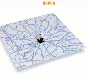 Places with similar names to Kāpra, India ::
Disclaimer :: Information on this page comes without warranty of any kind |
||
|
Where is Kāpra? Elevation and coordinates ::
Latitude (lat): 17°29'12"N Longitude (lon): 78°33'58"E
Elevation (approx.): 545m (map arrows pan, magnifying glasses zoom) |
||
|
Visiting Kāpra? Hotel/Accommodation ::
Book a hotel in Kāpra Travel Guide ::
Buy a travel guide for India rental cars ::
car rental offers GPS waypoint ::
download a GPX waypoint (PoI) of Kāpra for your GPS receiver
|
||