|
search place name
|
||
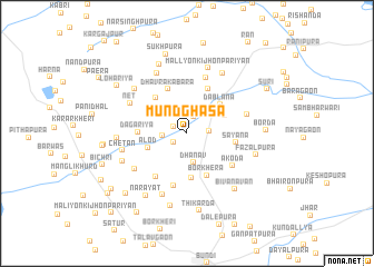
Mūndghasa (Rājasthān, India)Mūndghasa is a town in the Rājasthān region of India. An overview map of the region around Mūndghasa is displayed below.
regional and 3d topo map of Mūndghasa, India ::
Mūndghasa airports ::
The nearest airport is KTU - Kota, located 49.5 km south east of Mūndghasa.
Other airports nearby include JAI - Jaipur (141.5 km north), UDR - Udaipur (203.1 km south west), Nearby towns ::
Anantganj (1.4km north west) //
Dābla (1.5km south west) //
Khatāwada (1.7km north) //
Nayāgaon (2.0km east) //
Bālapura (2.2km west) //
Dhanāv (3.0km south) //
Alod (3.8km west) //
Lodha ka Jhonpara (3.9km north east) //
Dablāna (4.2km north east) //
Dhanāv (4.5km south) //
Borkhera (4.6km south east) //
Dhāvra (4.5km north west) //
Dhāvra ka Bāra (4.7km north) //
Kanjar Colony (4.8km north east) //
Dagariya (4.5km west) //
Sayāna (4.6km east) //
Kābul ki Jhonpariyān (5.2km south west) //
Rāmchandraji ka Khera (5.4km south) //
Ākoda (5.3km south east) //
Bhawānīpura (5.8km north) //
Hulāspura (5.7km east) //
Kālābhāta (6.0km south west) //
Net (6.0km north west) //
Chetan (6.0km west) //
Trishūliya (6.6km south) //
Rāmniwās (6.6km north west) //
Hīra ka Bāra (6.5km north west) //
Māllyon ki Jhonpariyān (6.8km north) //
Akoliya (6.9km north east) //
[all distances 'as the bird flies' and approximate] 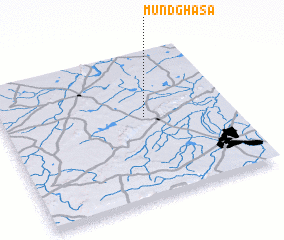
Disclaimer :: Information on this page comes without warranty of any kind |
||
|
Where is Mūndghasa? Elevation and coordinates ::
Latitude (lat): 25°33'31"N Longitude (lon): 75°37'25"E
Elevation (approx.): 280m (map arrows pan, magnifying glasses zoom) |
||
|
Visiting Mūndghasa? Hotel/Accommodation ::
Book a hotel in Mūndghasa Travel Guide ::
Buy a travel guide for India rental cars ::
car rental offers GPS waypoint ::
download a GPX waypoint (PoI) of Mūndghasa for your GPS receiver
|
||