|
search place name
|
||
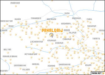
Pahaldaij (Jammu and Kashmīr, India)Pahaldaij is a town in the Jammu and Kashmīr region of India. An overview map of the region around Pahaldaij is displayed below.
regional and 3d topo map of Pahaldaij, India ::
Pahaldaij airports ::
The nearest airport is MFG - Muzaffarabad, located 63.3 km west of Pahaldaij.
Other airports nearby include SXR - Srinagar (74.6 km south east), RAZ - Rawala Kot Rawalakot (75.4 km south west), ISB - Islamabad Chaklala (136.3 km south west), GIL - Gilgit (163.7 km north), Nearby towns ::
Wopazwain (0.8km north west) //
Wārapur (1.4km east) //
Ashkanpur (1.5km east) //
Wāgat (1.6km north east) //
Krumhur (2.2km south) //
Pāzalpur (2.2km north east) //
Kakrosa (2.2km west) //
Sonamul (2.5km north west) //
Talawār (2.6km north west) //
Pālapur (2.4km east) //
Cheramunji (3.1km north) //
Sarmarg (3.1km south west) //
Dolipura (3.0km north west) //
Zafarkhani (2.8km west) //
Chak Giripur (3.0km north east) //
Khaipur (3.8km south east) //
Hamla (4.0km south) //
Wuchhar (3.8km north east) //
Sultānpur (4.1km south) //
Shoghapur (3.6km east) //
Kanjua (4.3km north west) //
Giripur (3.7km east) //
Tompur (3.8km east) //
Vilgām (4.4km north west) //
Cherkot (4.8km north) //
Gund (4.3km north west) //
Wolyas Kaonār (4.2km west) //
Vilgām (4.6km north west) //
Didikūt (5.1km north) //
[all distances 'as the bird flies' and approximate] 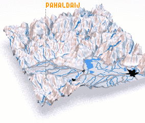 Places with similar names to Pahaldaij, India :: Disclaimer :: Information on this page comes without warranty of any kind |
||
|
Where is Pahaldaij? Elevation and coordinates ::
Latitude (lat): 34°26'55"N Longitude (lon): 74°11'5"E
Elevation (approx.): 1726m (map arrows pan, magnifying glasses zoom) |
||
|
Visiting Pahaldaij? Hotel/Accommodation ::
Book a hotel in Pahaldaij Travel Guide ::
Buy a travel guide for India rental cars ::
car rental offers GPS waypoint ::
download a GPX waypoint (PoI) of Pahaldaij for your GPS receiver
|
||