|
search place name
|
||
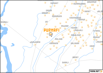
Purmāfi (Uttar Pradesh, India)Purmāfi is a town in the Uttar Pradesh region of India. An overview map of the region around Purmāfi is displayed below.
regional and 3d topo map of Purmāfi, India ::
Purmāfi airports ::
The nearest airport is DEL - Delhi Indira Gandhi Intl, located 109.5 km south of Purmāfi.
Other airports nearby include DED - Dehra Dun Dehradun (113.4 km north east), IXC - Chandigarh (133.6 km north), LUH - Ludhiaha Ludhiana (193.0 km north west), Nearby towns ::
Durgāhpur (1.4km west) //
Naunāhli (1.7km north) //
Tāna (1.8km south) //
Chaundāheri (1.7km north west) //
Ambahta Rindān (2.7km north east) //
Hasenpur (2.6km north east) //
Polkha (2.9km south east) //
Karāwra (3.5km south) //
Khera Bhāu (3.8km north) //
Garhī Pūkhta (3.5km east) //
Odri (3.7km east) //
Mālaindi (4.4km south) //
Kherki (4.2km north east) //
Khera (4.6km south) //
Ūn (4.8km north) //
Rājhar (5.2km north east) //
Jahāngīrpur (5.6km north east) //
Bhainswāl (5.5km south east) //
Māzra Haripur (5.5km east) //
Jhinjhāna (6.0km south west) //
Māzra Pathānpur (6.0km north east) //
Pandaura (6.8km north) //
Jandheri (6.0km east) //
Qāzīpur (6.2km east) //
Dūla Kheri (7.0km north east) //
Sāmpla (8.1km north) //
Gāgor (8.0km north) //
Thirwa (7.5km east) //
Jasāna (7.5km east) //
[all distances 'as the bird flies' and approximate] 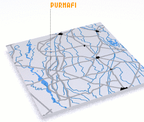 Places with similar names to Purmāfi, India ::
Disclaimer :: Information on this page comes without warranty of any kind |
||
|
Where is Purmāfi? Elevation and coordinates ::
Latitude (lat): 29°32'37"N Longitude (lon): 77°16'15"E
Elevation (approx.): 249m (map arrows pan, magnifying glasses zoom) |
||
|
Visiting Purmāfi? Hotel/Accommodation ::
Book a hotel in Purmāfi Travel Guide ::
Buy a travel guide for India rental cars ::
car rental offers GPS waypoint ::
download a GPX waypoint (PoI) of Purmāfi for your GPS receiver
|
||