|
search place name
|
||
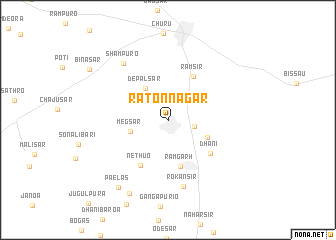
Ratonnagar (Rājasthān, India)Ratonnagar is a town in the Rājasthān region of India. An overview map of the region around Ratonnagar is displayed below.
regional and 3d topo map of Ratonnagar, India ::
Ratonnagar airports ::
The nearest airport is JAI - Jaipur, located 175.7 km south east of Ratonnagar.
Other airports nearby include JOH - Jodhpur (287.9 km south west), Nearby towns ::
Hunathpura (2.7km east) //
Depālsar (4.1km north west) //
Megsar (3.9km west) //
Chāran ki Dhāni (4.4km south east) //
Rāmgarh (5.3km south) //
Rāmsir (5.5km north east) //
Nethuo (5.8km south west) //
Dhāni (5.6km south east) //
Rokansir (7.6km south) //
Shāmpuro (7.7km north west) //
Bābla (9.0km south west) //
Paelās (9.0km south west) //
Bināsar (9.5km north west) //
[all distances 'as the bird flies' and approximate] 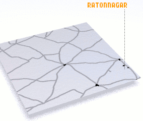 Places with similar names to Ratonnagar, India ::
// Radu Negru (RO)
// Radu Negru (RO)
// Radu Negru (RO)
// Rotongaro (NZ)
// Ratangarh (IN)
// Ratangarh (IN)
// Rutungura (TZ)
// Rutunguru (TZ)
// Ratangarh (PK)
// Ratan Kara (PK)
Disclaimer :: Information on this page comes without warranty of any kind |
||
|
Where is Ratonnagar? Elevation and coordinates ::
Latitude (lat): 28°12'48"N Longitude (lon): 74°57'15"E
Elevation (approx.): 300m (map arrows pan, magnifying glasses zoom) |
||
|
Visiting Ratonnagar? Hotel/Accommodation ::
Book a hotel in Ratonnagar Travel Guide ::
Buy a travel guide for India rental cars ::
car rental offers GPS waypoint ::
download a GPX waypoint (PoI) of Ratonnagar for your GPS receiver
|
||