|
search place name
|
||
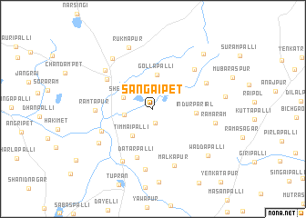
Sangaipet (Andhra Pradesh, India)Sangaipet is a town in the Andhra Pradesh region of India. An overview map of the region around Sangaipet is displayed below.
regional and 3d topo map of Sangaipet, India ::
Sangaipet airports ::
The nearest airport is HYD - Hyderabad, located 52.9 km south of Sangaipet.
Nearby towns ::
Potampalli (1.7km south) //
Makarājpet (2.2km north) //
Gujgatiapalli (3.4km north east) //
Dasnālkunta (3.4km west) //
Sheonūr (3.7km west) //
Timmaipalli (4.0km south west) //
Gollapalli (4.2km north) //
Indūrparial (5.0km east) //
Dātarpalli (6.3km south) //
Waddiāram (6.5km north west) //
Māsaipet (6.6km south west) //
Dipāmpalli (6.9km north east) //
Rāmtāpur (6.8km west) //
Konāpur (7.0km north east) //
Islāmpur (7.4km south west) //
Shekotla (7.2km north west) //
Malkāpur (7.4km south) //
Jahurābād (7.5km south) //
Bomāram (7.6km south west) //
Ramaram (7.5km east) //
Reddipalli (7.8km north west) //
Rukmāpur (8.0km north) //
Waddapalli (8.6km south east) //
Tirmalāpur (8.6km east) //
Daulatābād (8.9km north east) //
[all distances 'as the bird flies' and approximate]  Places with similar names to Sangaipet, India ::
// Sungai Padi (TH)
// Sangaipet (IN)
// Sangupet (IN)
// Sangapati (ID)
// Singopadu (ID)
// Sungai Apit (ID)
// Sungaiapit (ID)
// Sungaipetai (ID)
// Sengapadai (LK)
// Sanguipata (PE)
Disclaimer :: Information on this page comes without warranty of any kind |
||
|
Where is Sangaipet? Elevation and coordinates ::
Latitude (lat): 17°55'44"N Longitude (lon): 78°31'3"E
Elevation (approx.): 553m (map arrows pan, magnifying glasses zoom) |
||
|
Visiting Sangaipet? Hotel/Accommodation ::
Book a hotel in Sangaipet Travel Guide ::
Buy a travel guide for India rental cars ::
car rental offers GPS waypoint ::
download a GPX waypoint (PoI) of Sangaipet for your GPS receiver
|
||